Services

Forensic Mapping, Reality Capture & Technical Site Documentation

SterFlies documents physical site conditions using aerial, terrestrial, thermal, and photogrammetric capture methods selected according to the site, project objective, and required deliverables.

Primary services

Documentation selected for the work

Services are organized by the record being produced. Hardware, sensors, and software are methods used inside those services.

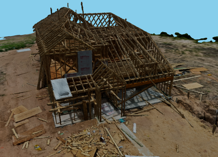
3D reconstruction of a structure under construction

01

Forensic Mapping & Site Documentation

Preserve site conditions as measurable visual and spatial records for later professional review.

Typical uses

  • Forensic consultants
  • Attorneys
  • Expert witnesses
  • Industrial hygienists
  • Safety / EHS teams
  • Engineers
  • Insurers
  • Construction professionals

Possible deliverables

  • Orthomosaics
  • 3D models
  • Point clouds
  • Site imagery
  • Walkthroughs
  • Measurements
  • Annotated imagery
  • Supporting files

Capture methods may include Aerial imagery, Photogrammetry, Terrestrial / interior capture, 360 documentation, High-resolution photography, Thermal where appropriate. Not every project includes every deliverable.
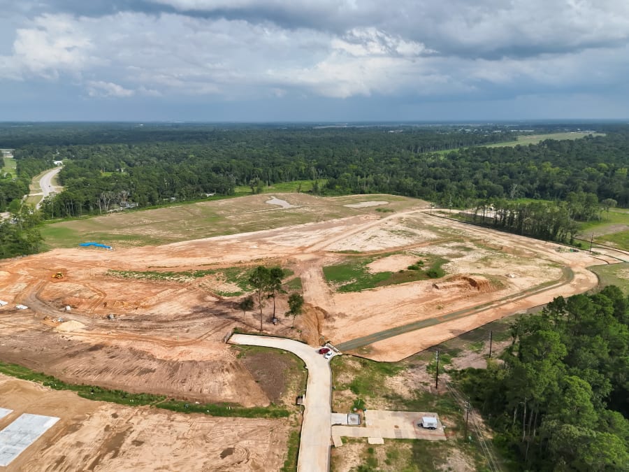
Aerial mapping of a 65-acre development site

02

Mapping & Photogrammetry

Create measurable 2D and 3D site records for construction, industrial, and technical workflows.

Typical uses

  • Construction progress
  • Existing conditions
  • Industrial sites
  • Site mapping
  • Stockpile / volume documentation
  • Large properties
  • Earthwork / terrain context
  • Recurring project records

Possible deliverables

  • Orthomosaics
  • Point clouds
  • 3D models
  • Volumetric outputs
  • Surface / elevation outputs
  • High-resolution imagery
  • Agreed technical exports

Capture methods may include Overlapping image capture, Photogrammetric processing, Repeatable site coverage. Not every project includes every deliverable.
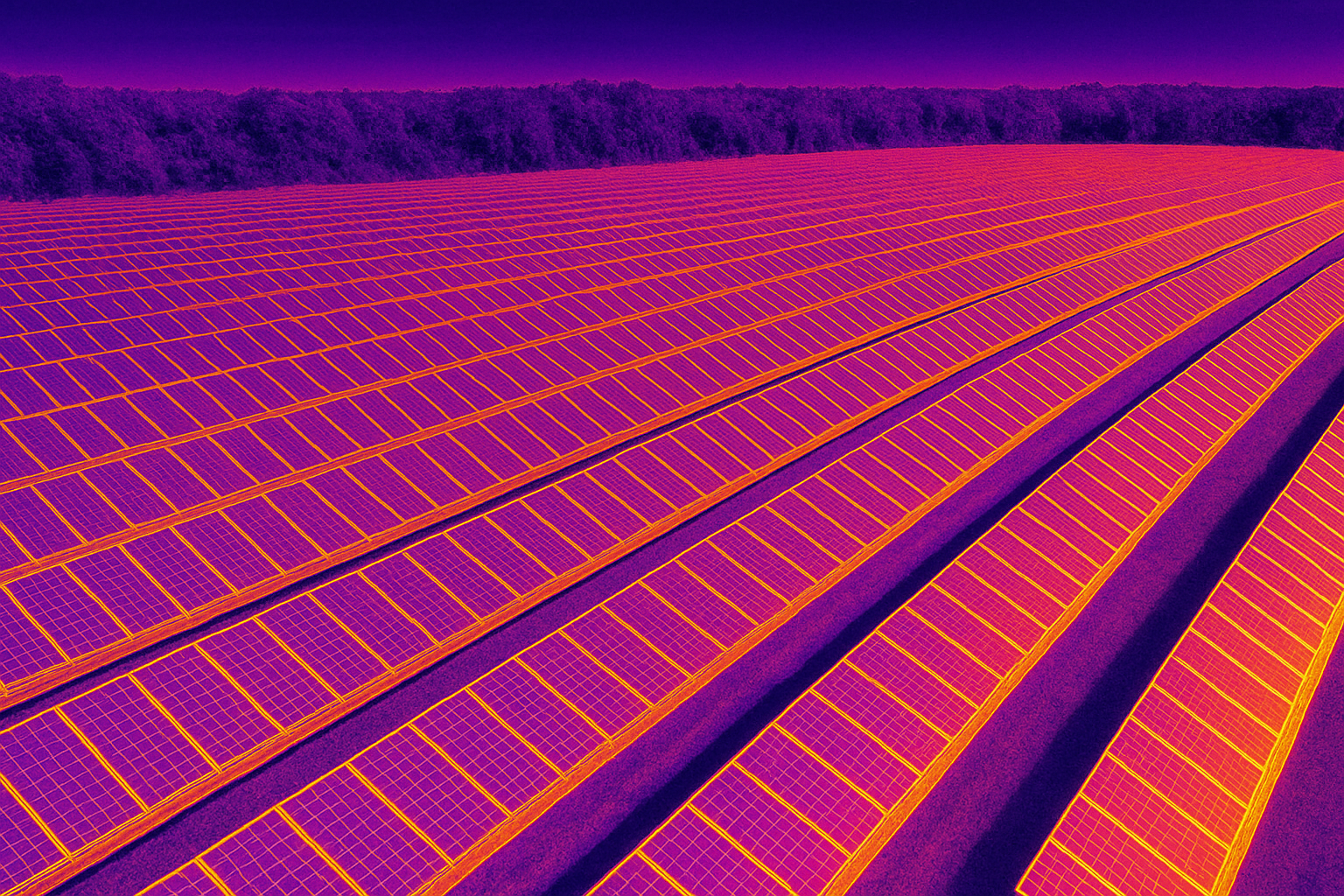
Thermal documentation of a photovoltaic array

03

Thermal Documentation

Temperature-pattern documentation used to support inspection and technical review workflows.

Typical uses

  • Solar PV
  • Electrical systems
  • Building envelope
  • Industrial assets
  • Roofing / moisture-investigation support

Possible deliverables

  • Thermal imagery
  • RGB context frames
  • Location context
  • Supporting files as scoped

Capture methods may include Radiometric thermal capture, Paired RGB context, Location-referenced stills. Not every project includes every deliverable.

Capability

Interior & Ground-Based Reality Capture

Terrestrial capture is used when aerial coverage cannot preserve the context that later review requires.

Ground-based documentation is selected for interiors, room relationships, equipment spaces, access routes, IAQ and mold environments, and other areas where aerial systems cannot capture useful context. Combined aerial and terrestrial records can preserve a more complete site condition than either method alone.

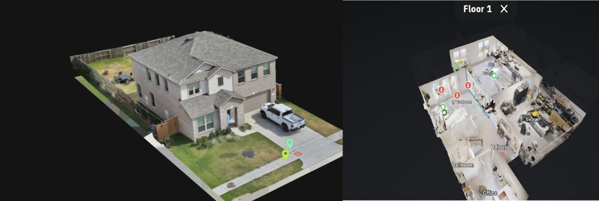
Tools such as Matterport are used when an interactive walkthrough is the appropriate deliverable. The product is the interior record, not the scanner.

View aerial and ground-based capture
Combined interior and exterior 3D documentation of existing site conditions

Applications

Where the services are used

Applications are professional contexts. They route into an existing service, project, or article.

Need a site documented?

Tell us what needs to be captured, measured, or preserved and we can determine the appropriate documentation approach.