
Why Progress Monitoring Matters More Than Ever
Construction projects today involve more stakeholders than ever before. Owners, developers, lenders, inspectors, subcontractors, architects, and legal teams all rely on accurate information to make decisions. When progress documentation is unclear or incomplete, small misunderstandings can escalate into delays, disputes, or financial losses.
Effective progress monitoring provides a shared source of truth. It allows everyone to see what has been completed, what is in progress, and what conditions existed at specific points in time. When documentation is visual, objective, and consistent, it removes ambiguity and reduces reliance on memory or subjective reporting.
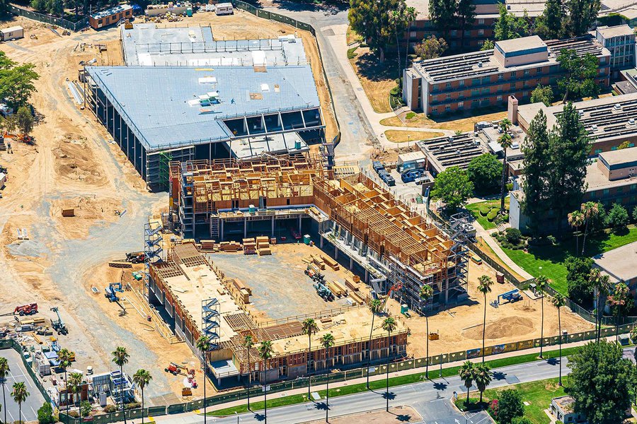
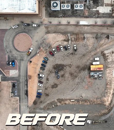
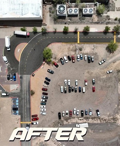
Aerial documentation adds another layer of clarity by capturing the entire site from a consistent vantage point, something ground-based photos simply cannot do.
The Advantage of Regular Aerial Captures
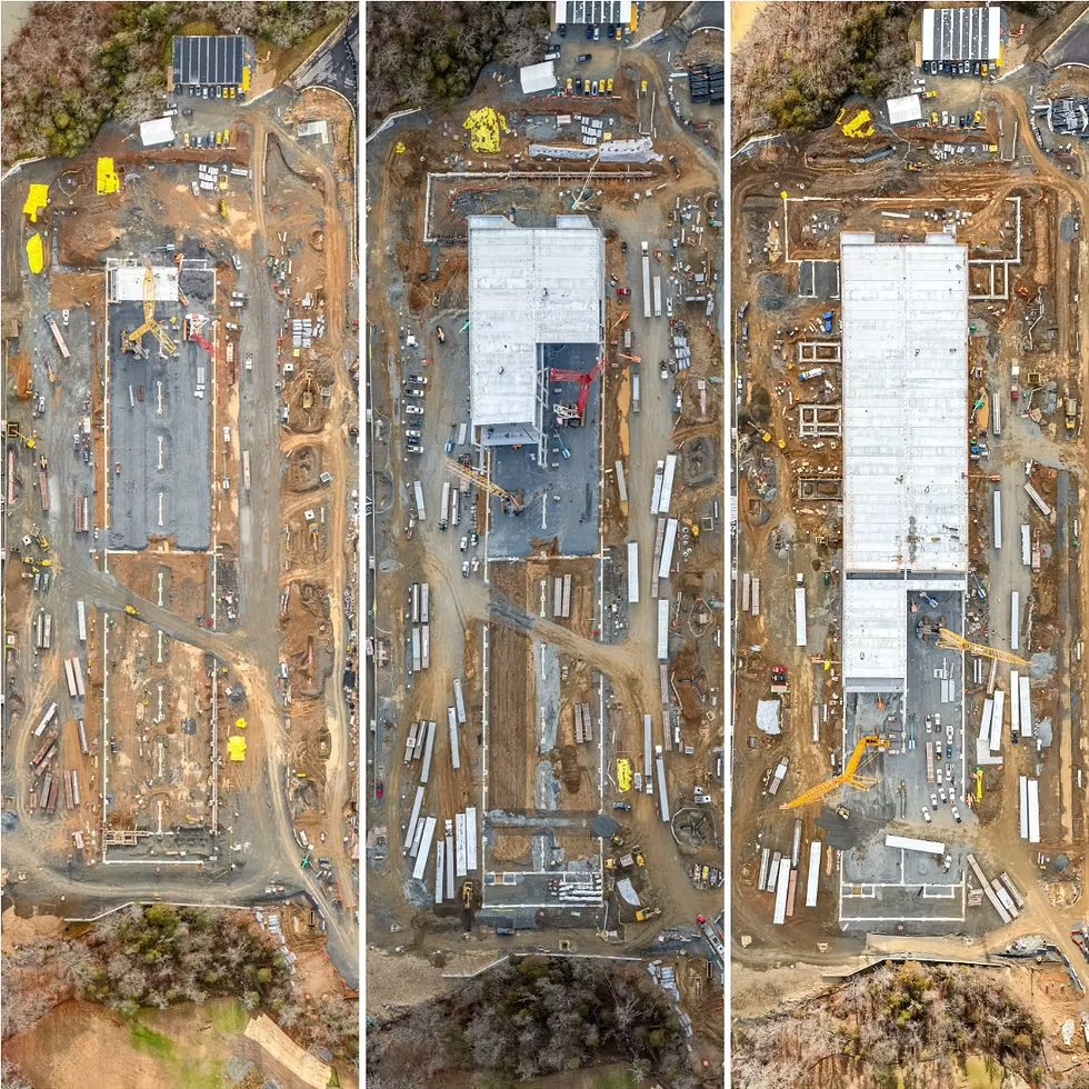
One of the biggest mistakes in construction documentation is treating aerial imagery as a one-time deliverable. A single drone flight might look impressive, but it offers limited value without historical context. The real power comes from regular, repeatable captures.
By flying the site on a scheduled basis, whether weekly, bi-weekly, or monthly, site managers create a visual timeline of progress. This allows changes to be tracked objectively over time and makes it easy to answer questions like when did grading finish, when did utilities go in, or when was a structure fully enclosed.
Regular aerial captures help ensure consistency. When flights are conducted using the same flight paths, altitudes, and camera angles, progress comparisons become far more accurate and reliable.
Tracking Progress with Orthomosaic Maps
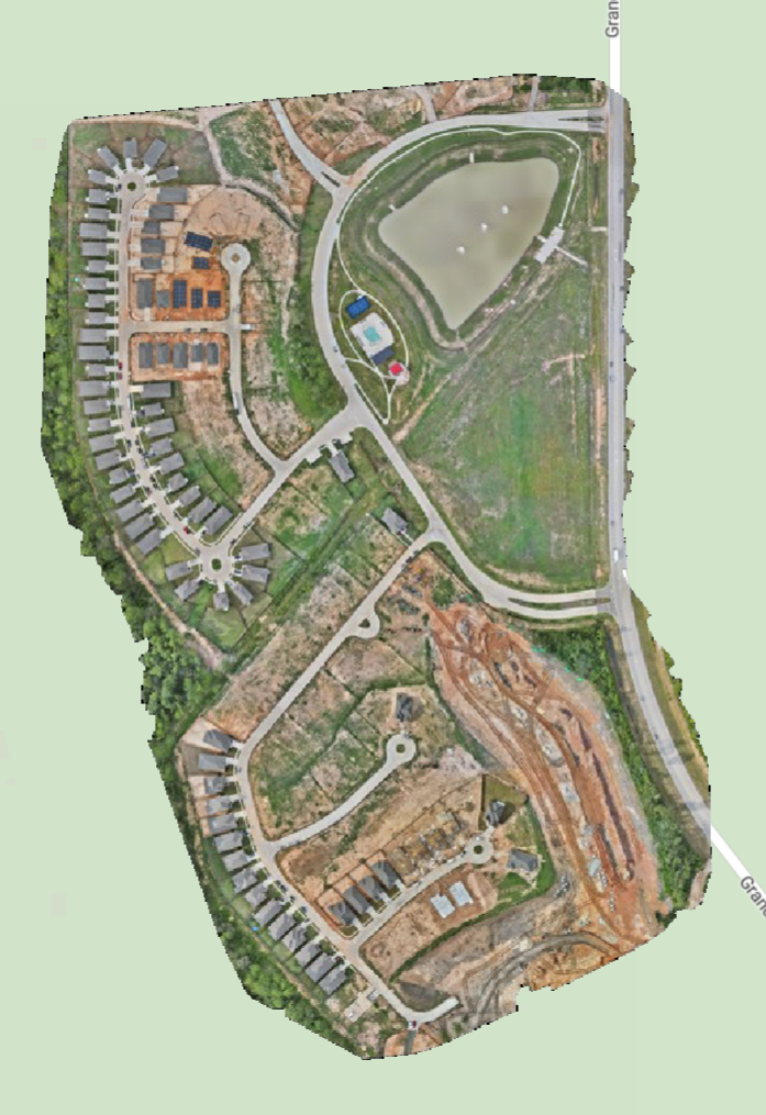
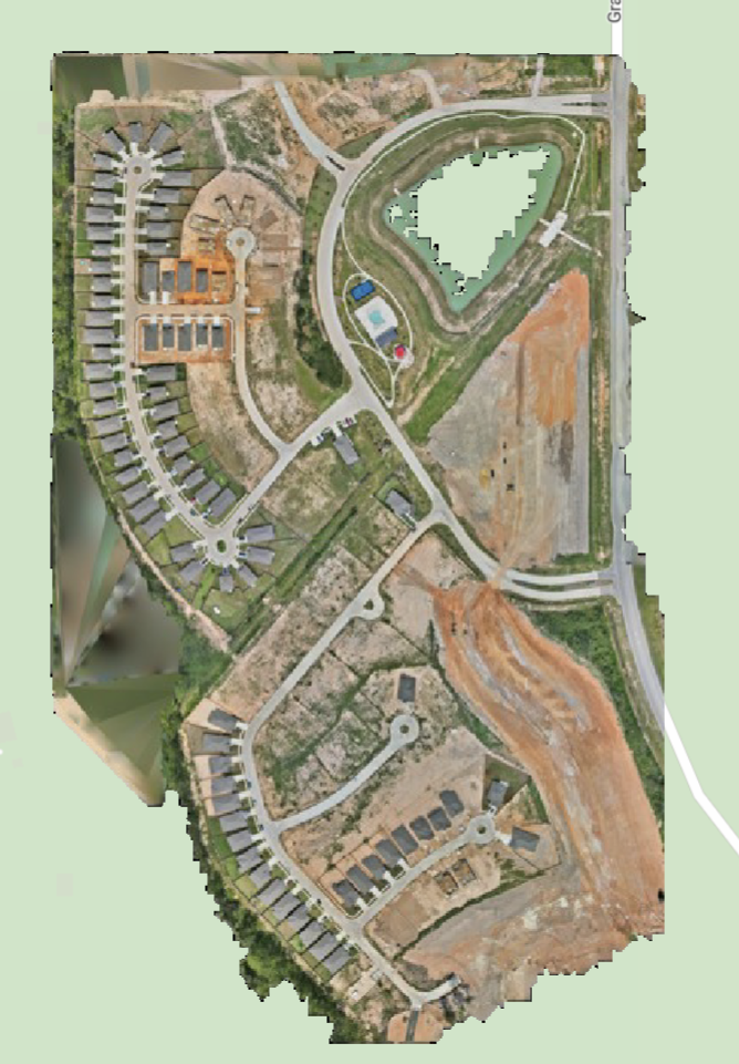
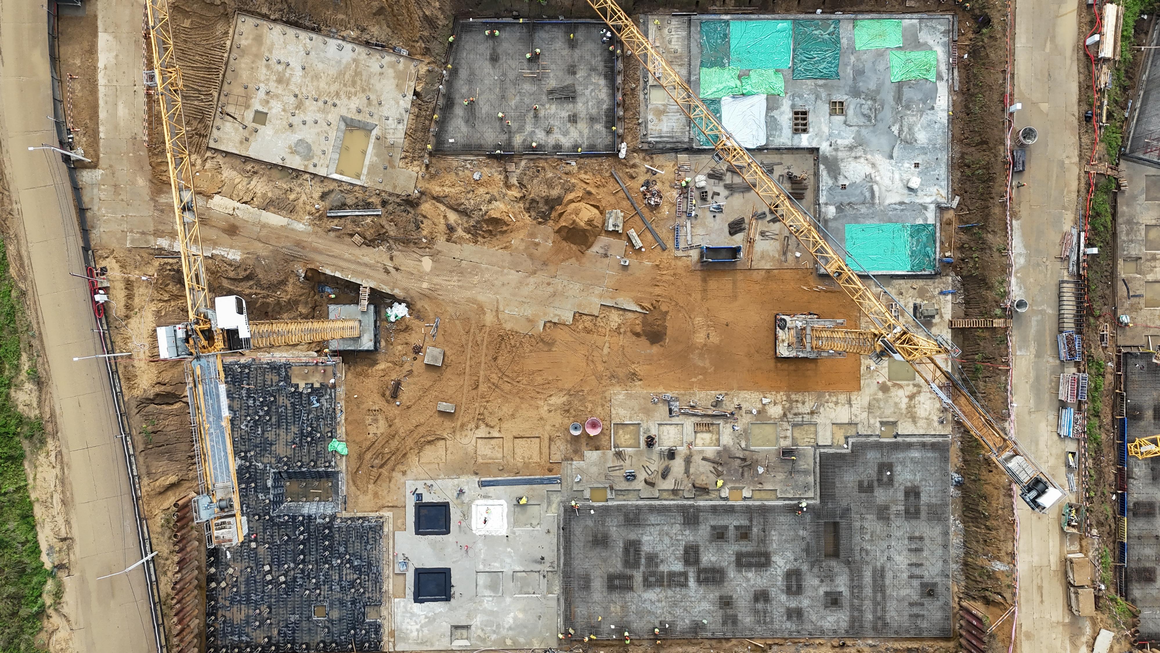
Orthomosaic maps are high-resolution, georeferenced images stitched together from multiple aerial photographs. Unlike standard photos, orthomosaics are scale-accurate and can be measured.
For site managers, this means progress is not just visible, it is quantifiable. You can verify grading extents, confirm pad dimensions, track material placement, and visually confirm work completed by specific trades.
Orthomosaics are especially valuable for large or complex sites where walking the entire footprint regularly is impractical. They allow teams to review progress remotely while still maintaining spatial accuracy.
Improving Communication with Stakeholders
One of the most overlooked benefits of aerial progress monitoring is how dramatically it improves communication. Visual data eliminates guesswork. Instead of explaining conditions verbally or through dense reports, site managers can simply show the site as it exists.
This is particularly valuable when working with remote stakeholders who cannot visit the site frequently. Owners and investors can quickly understand progress without needing technical construction knowledge. Architects and engineers can visually verify installation sequencing. Lenders can confirm milestones tied to funding releases.
Clear visuals reduce the number of clarification emails, meetings, and site visits required to keep everyone aligned.
Avoiding Disputes Through Visual Records
Disputes often arise not because of bad intent, but because of missing context. Questions like who installed what, when did damage occur, or what conditions existed before work began are difficult to answer without reliable records.
Regular aerial documentation creates a neutral, time-stamped visual archive of the site. This can be invaluable when addressing change orders, verifying completed work, or resolving disagreements between trades.
In some cases, progress documentation becomes critical evidence during claims or litigation. Having clear aerial records showing site conditions at specific dates can protect both site managers and project owners by providing objective proof rather than relying on recollection.
Enhancing Safety Oversight from Above
Safety is another area where aerial monitoring provides meaningful benefits. Drones allow site managers to observe areas that may be difficult or unsafe to access on foot. This includes roof structures, excavation edges, stockpiles, and active work zones.
From an aerial perspective, it becomes easier to spot potential safety issues such as improper material staging, inadequate barricades, or unsafe access paths. Addressing these issues early can prevent accidents and keep projects compliant with safety standards.
Importantly, aerial safety reviews reduce the need for personnel to enter hazardous areas solely for inspection purposes.

Establishing a Repeatable Documentation Workflow
To get the most value from aerial progress monitoring, consistency is key. Best practices include flying on a regular schedule, capturing the site from the same angles each time, and organizing deliverables in a way that makes historical comparisons easy.
Successful site managers treat aerial documentation as part of their core reporting workflow, not as a novelty. When integrated into weekly updates or monthly reports, aerial visuals become a trusted reference point for decision-making.
Equally important is ensuring that imagery is archived and easily accessible. Cloud-based delivery allows teams to review site conditions from anywhere, even months or years later.
A Smarter Way to Manage Construction Progress
Construction progress monitoring is no longer just about checking boxes or documenting milestones after the fact. With modern aerial documentation, site managers gain a proactive tool that supports better planning, clearer communication, and stronger risk management.
By capturing regular, consistent aerial data, teams gain visibility that extends beyond what is possible from the ground. The result is fewer surprises, fewer disputes, and greater confidence across every phase of the project.
For site managers tasked with keeping complex projects on track, aerial progress monitoring is no longer optional. It is becoming an essential part of how successful construction projects are managed.
Want a clearer progress timeline for your project
SterFlies provides repeatable aerial documentation and mapped deliverables that help teams track progress, communicate clearly, and reduce ambiguity across stakeholders.