At SterFlies, we follow a rigorous workflow to ensure accurate, reliable, and actionable thermal data. From mission planning to final report delivery, our approach leverages cutting-edge DJI Matrice 4T hardware and advanced analytics software.
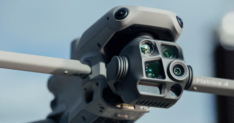
Equipment & Platform
We deploy the DJI Matrice 4T—our flagship thermal drone platform—equipped with 640x512 resolution thermal camera. Key specifications include:
Max Flight Time: up to 38 minutes per battery
RTK Module: Built in RTK Module that delivers centimeter-level positional accuracy—keeping thermal overlays aligned within just ±2 cm of real-world coordinates.
Transmission Range: Up to 15.5 miles with DJI O4 Enterprise system.
Laser Rangefinder: Measurement Range: 1800 m (1 Hz) @20% reflectivity target. Blind Zone: 1 m. Distance Measurement Accuracy: 1-3 m: System Error less than 0.3 m, Random Error less than 0.1 meters @1σ
Operational Temp: –20 °C to 50 °C
This robust setup enables high-altitude, stable flights even in challenging environments—capturing crisp thermal data for every job.
Step 1: Mission Planning
Our team analyzes site maps, client objectives, and environmental factors to design flight paths that ensure full coverage and optimal thermal resolution. We consider altitude, emissivity, reflectivity, overlap, and speed to balance image detail with efficient operation.
Step 2: Data Acquisition
Using the Matrice 4T and Zenmuse H20T, we execute pre-approved flight plans in compliance with FAA regulations. Real-time telemetry and thermal preview allow us to adjust camera settings on-the-fly and confirm data quality before concluding the mission.
Step 3: Processing & Analysis
Raw thermal footage and stills are imported into our analysis suite for georeferencing, radiometric calibration, and heat-map generation. We integrate GIS layers and NDVI indices when crop or vegetation metrics are required.
Step 4: Reporting & Delivery
Clients receive a comprehensive report featuring high-resolution thermal images, annotated maps, trend analysis, and clear action items. Reports are delivered as interactive PDFs and optional web dashboards for ongoing monitoring.