Site Progress Tracking & Measurements
At SterFlies, we transform aerial imagery into precise, actionable data. From 2D and 3D models to volumetric and cut/fill reports, our photogrammetry services provide the clarity you need to plan, monitor, and analyze your projects with confidence.
What We Offer
Routine Flights
Weekly or bi-weekly aerial photography sessions
Still image & Video Capture
High-resolution photos and 4K videos for progress documentation.
Topographic Mapping
Detailed elevation and contour models for surveying and planning.
Orthomosaic Maps (2D)
Orthomosaic maps for detailed site analysis
3D Models & Digital Twins
Interactive site models for planning, visualization, and presentations.
Volumetric & Cut/Fill Analysis
Accurate volume calculations and cut/fill reports for earthworks.
Custom Deliverables
Tailored reporting packages in formats like GeoTIFF, LAS, OBJ, and DWG.
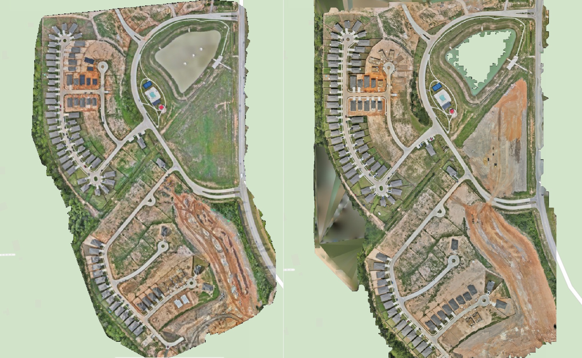
Progress Monitoring
We capture high-resolution aerial imagery at scheduled intervals to document site progress over time. Using consistent flight paths, we produce orthomosaics and time-lapse visuals that create a clear, chronological record for progress updates reporting, and stakeholder communication
Why Choose SterFlies?
Safety First
Fully FAA Part 107 certified pilots and $2M liability insurance.
Centimeter Accuracy
RTK-enabled GPS for sub-inch precision.
Fast Turnaround
Deliverables within 24–48 hours of flight.
Insightful Data
Actionable insights tailored to your needs.