Forensic Site Documentation
From active construction sites to post-incident locations, our forensic site documentation services preserve site conditions exactly as they exist at a specific point in time. Using aerial and ground-based capture, we create accurate visual and spatial records that support investigation, verification, and dispute review. Whether documenting progress, existing conditions, or physical evidence, our deliverables provide a clear, reviewable record that remains usable long after conditions change.
What We Offer
High-Res Photos & or Videos
High-Res photos to capture specifics
Thermal Imaging
Infrared (IR) scanning included if needed.
3D Site Models
Interior & Exterior 3D scanning for full visual context.
Detailed Reports
Structured reports including measurements, annotations, and visual references for documentation and review.
Virtual Tours
Ground-level 3D walkthroughs that allow remote review of interior and exterior site conditions with annotations.
Custom Services
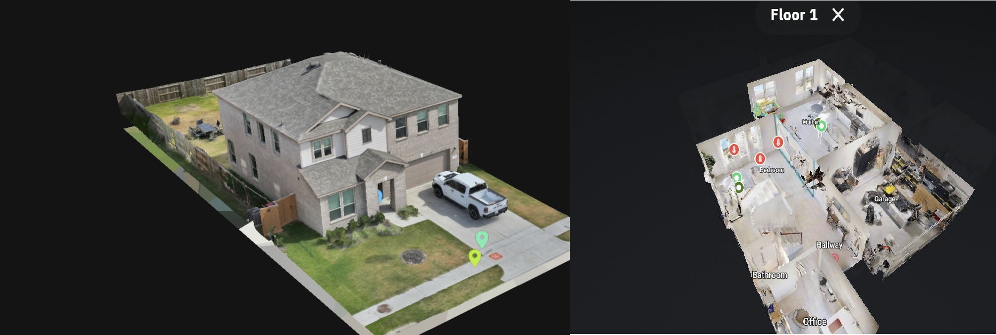
Exterior Model and Interior Walkthrough Example
Example of an exterior-to-interior site capture used during an indoor air quality assessment (IAQ). This walkthrough preserves spatial context, room relationships, and observed conditions at the time of inspection, creating a reviewable visual record that supports analysis and reporting.
3D Imaging
We capture high-resolution aerial & ground imagery to create detailed 3D models of sites. These models allow for immersive virtual exploration and accurate measurements.
Why Choose SterFlies?
Context-Aware Documentation
Documentation informed by site layout, access constraints, and physical conditions to ensure clarity and consistency.
Pinpoint Accuracy
LiDar and RTK-enabled positioning used to improve spatial consistency and measurement reliability.
Quick Turnaround
Efficient turnaround times based on project scope and documentation requirements.
Full Support
End-to-end coordination and technical support throughout the documentation process.