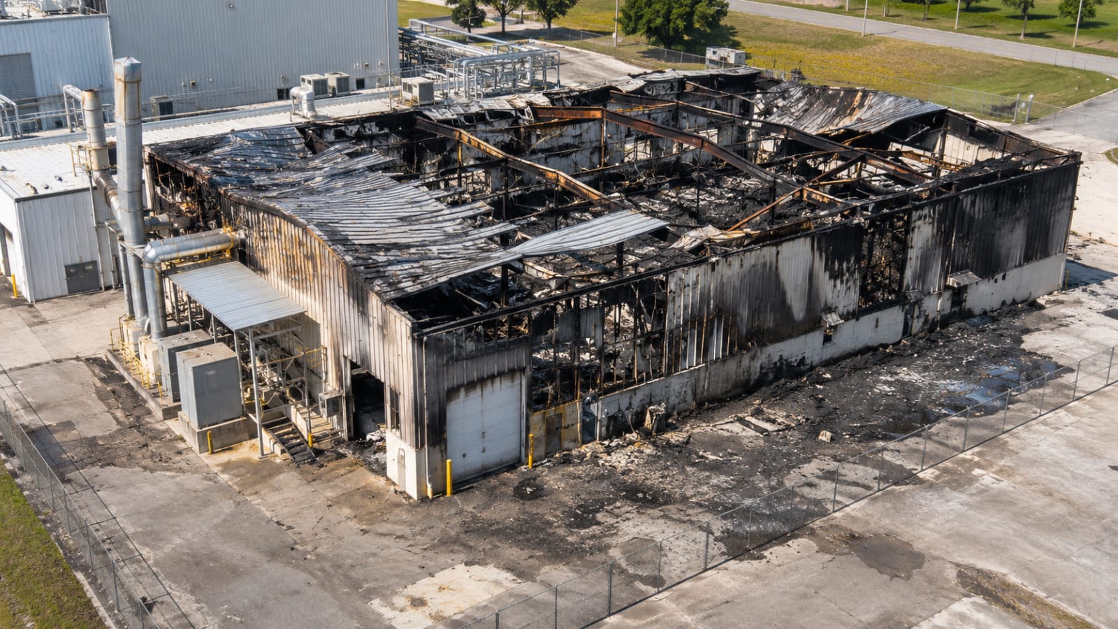
A serious fire can transform an industrial facility in minutes. Wall panels buckle, piping loses support, ceiling materials fall, and equipment may be displaced. Then the scene changes again. Emergency crews move through the facility, damaged structures are stabilized, and eventually someone has to clear debris so the facility can be repaired or demolished.
Investigators need a reliable picture of what remained after the event, including features that might not survive the next stage of work. Photographs and written observations are essential. In some situations, aerial mapping, 3D scanning, and carefully planned ground photography can also help document the arrangement of damaged equipment, structural openings, access routes, and debris. These records support examination, not explanation of the fire by themselves.
The National Fire Protection Association’s NFPA 921 provides a systematic approach to fire and explosion investigation, including the documentation and evaluation of physical evidence (National Fire Protection Association). A scan is one method for collecting spatial observations within that broader process.
Scene Control Comes Before the Camera
The first decision is not which camera to use. It is whether documentation can proceed without interfering with emergency operations or exposing personnel to uncontrolled hazards. After an industrial fire, a structure may contain energized equipment, damaged pressure systems, unstable floors, hazardous residues, or an atmosphere that has not been assessed. A fire may be extinguished while the site remains unsafe to enter.
OSHA’s incident response guidance warns personnel against accessing structures or equipment when structural integrity is uncertain, unless the necessary evaluation and controls are in place. That principle applies to a documentation crew just as it does to other site visitors (Occupational Safety and Health Administration, “Field Safety and Health Management System”).
The lead investigator, incident command, site owner, and appropriate safety specialists determine where access is authorized and what activities are permitted. The operator then selects a method that fits those limits. A drone may provide useful exterior imagery from an approved location, but smoke, emergency aircraft, electrical hazards, or flammable vapors can make a flight inappropriate. A terrestrial scanner does not make entry into a compromised building safe.
Access restrictions should be documented. If a room, mezzanine, or process enclosure cannot be examined, the final deliverable should state this rather than leaving reviewers to assume the entire space was captured.
Start With the Equipment and the Surrounding Arrangement
Consider a manufacturing facility with a dust collector, conveying equipment, storage bins, and several connected process lines. A fire or explosion damages a portion of the system. The investigation may require a clear record of the locations of these components relative to openings, adjacent machinery, platforms, and building boundaries.
The field team should obtain a capture plan from the qualified investigator. The plan might call for an overview of the affected building, photographs of equipment identification plates, close-up views of damaged connections, and wider images that show how the individual components relate to one another. Capturing the entire facility at the expense of those specific details would be a poor use of time.
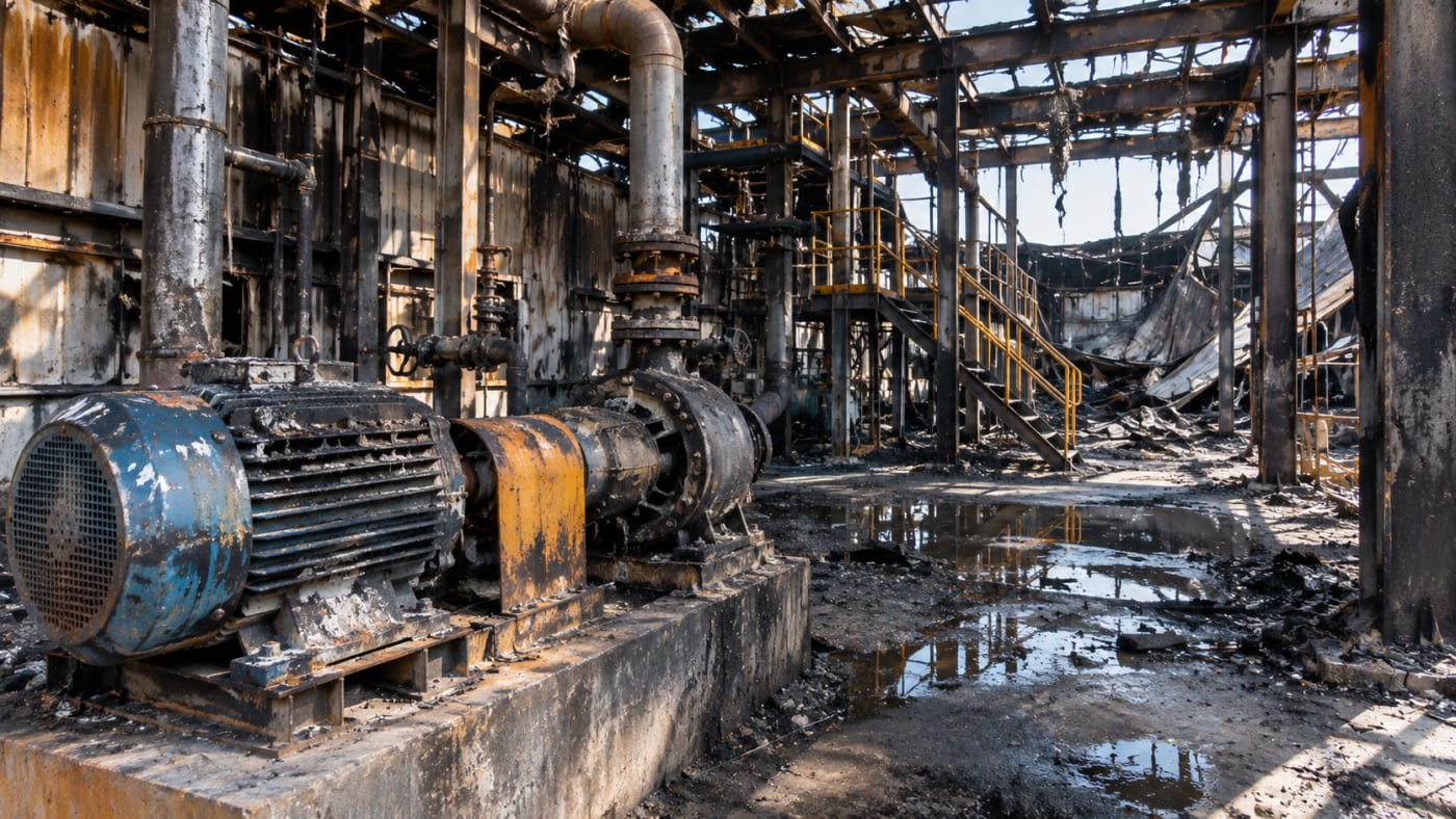
A model can help orient reviewers who were not present, especially when equipment spans multiple levels or when lines of sight are blocked by pipe racks. However, a model based on exterior imagery will not show the condition inside a closed vessel or reveal components behind sheet metal. Openings and inaccessible interiors may require separate examination by authorized specialists.
Spear & Lancaster’s process safety publications emphasize the importance of understanding industrial equipment, hazardous materials, and mechanical integrity to prevent major incidents (Spear & Lancaster). The physical documentation described here can support that work, while the interpretation of mechanical failures and process conditions remains with appropriately qualified professionals.
Recording Structural Damage Without Guessing at Its Cause
Fire-damaged buildings can present unfamiliar geometry. Roof framing may have sagged; walls may no longer be plumb; parts of a platform may have dropped into another work area. Wide-angle photographs show the extent of the scene, but individual images can make it difficult to follow the arrangement of structural features across a large building.
Ground scans or photogrammetry may provide a record of accessible surfaces and their relative positions. An exterior drone survey can show visible roof loss, wall openings, areas of collapse, and the relationship between the damaged structure and nearby buildings. Interior capture, when permitted, may record support members, equipment foundations, floor levels, and accessible debris fields.
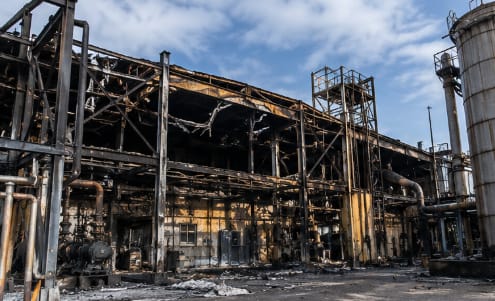
The resulting geometry should be described carefully. A visibly bent beam is an observation. Determining why it bent, when it moved, or whether it failed before or after a particular event requires additional evidence and analysis. Heat effects, impact, firefighting activity, and structural collapse can all complicate what a postincident scene appears to show.
For work involving demolition or removal of fire-damaged structures, OSHA identifies structural evaluation, appropriate bracing or shoring, and potential hazardous materials as relevant safety concerns (Occupational Safety and Health Administration, “OSHA Technical Manual”). Those decisions fall to the qualified project team, not the scanning operator.
Debris Locations Matter, but Timing Matters More
A piece of displaced ductwork may be found on the floor, far from its original position. A failed wall section might conceal equipment that was visible earlier. Investigators may need to document those locations before recovery work begins.
Photographs should show each significant item in context before collecting close-up details. A spatial model can help place an annotated image within the overall scene and preserve approximate relationships among visible objects. Each annotation needs to distinguish what the camera recorded from what an investigator later determined.
One problem is easy to miss: the scene captured by a scanner is the scene at the time of scanning. It is not automatically the scene as it existed at ignition, during an explosion, or immediately after suppression. Equipment may have been moved to reach a fire, debris may have been disturbed during rescue operations, and walls may have been opened to complete extinguishment.
If capture sessions occur before and after major scene work, keep them separate and identify the dates and stages. A chronological set of records is often more informative than combining all observations into a single model that appears to depict a single moment.
How Aerial and Interior Documentation Work Together
No single imaging method covers every industrial fire scene well. Aerial photography can establish the overall scene and identify visible exterior damage. A 3D interior scan may help reviewers navigate accessible rooms, platforms, and corridors. Close-up photographs remain the better choice for labels, connections, small damaged parts, and detailed surface observations.
For a large plant, an exterior orthomosaic may serve as a reference for building locations, access routes, and equipment yard locations. Oblique drone photographs provide perspective on elevations and overhead structures. An interior walkthrough then helps reviewers understand how accessible rooms and equipment spaces connect.
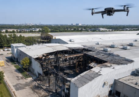
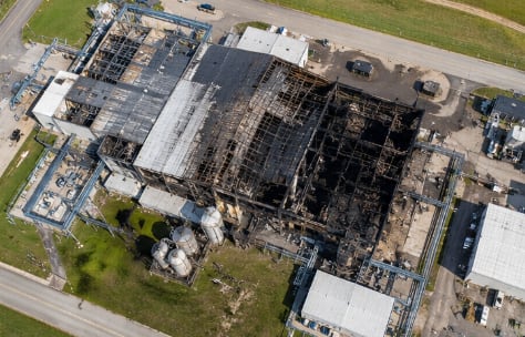
The two records may not share the same coordinate system or level of measurement accuracy. They should not be treated as a single verified survey simply because they can be displayed together. If distance or elevation is relevant to the investigation, the capture method and verification requirements should be established before relying on the value.
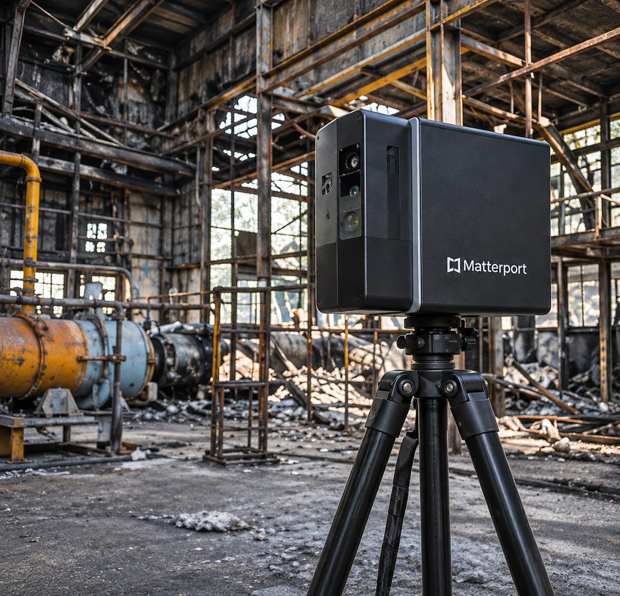
Matterport’s published case study on the forensic consulting firm Rimkus describes using 3D spaces after property losses so technical specialists can revisit documented rooms and review conditions after cleanup (Matterport). That is a useful example of how a navigable record fits into a consulting workflow, not evidence that every damaged building can be safely or completely scanned.
Deciding Whether a Model Is Detailed Enough
A visually convincing reconstruction can still omit the detail an investigator needs. Charred, low-texture surfaces, reflective sheet metal, standing water, smoke residue, and blocked camera views can all affect image-based reconstruction or optical scanning. Large openings, dark corners, and damaged surfaces may leave gaps.
Coverage checks should be performed on site when conditions permit. Review the model for any incomplete areas. Compare the available views with the investigator’s capture list. Photograph important damaged connections and identification labels separately, even if the surrounding space appears complete in the model.
The operator should also explain the types of measurements the deliverable supports. A browser-based measurement taken in a general visualization should not be presented as a verified engineering dimension. Instrument characteristics, scene conditions, control, registration, and independent checks determine whether a particular measurement is suitable for technical use.
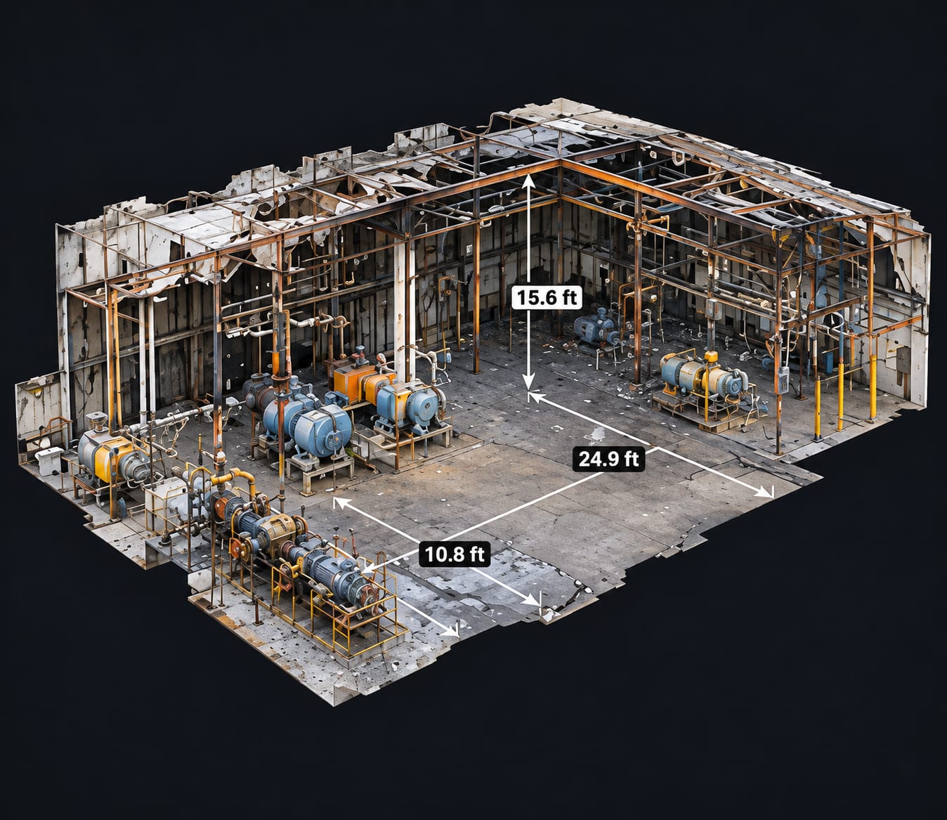
When precision is critical, a qualified surveyor, engineer, or other appropriate specialist may need to establish and verify the dimensions using methods suited to the question.
Preserving the Source Files and the Story of the Capture
The final deliverable is more than a link to a virtual tour. A reviewer should be able to determine when the scene was recorded, who collected it, which areas were accessible, and what processing was performed before the result was delivered.
A practical handover may include original photographs and video, an organized 3D model or point cloud, selected annotated views, a record of capture date and location, and notes on excluded or incomplete areas. If multiple site visits occurred, keep each version identifiable. Do not overwrite an earlier record with a later one.
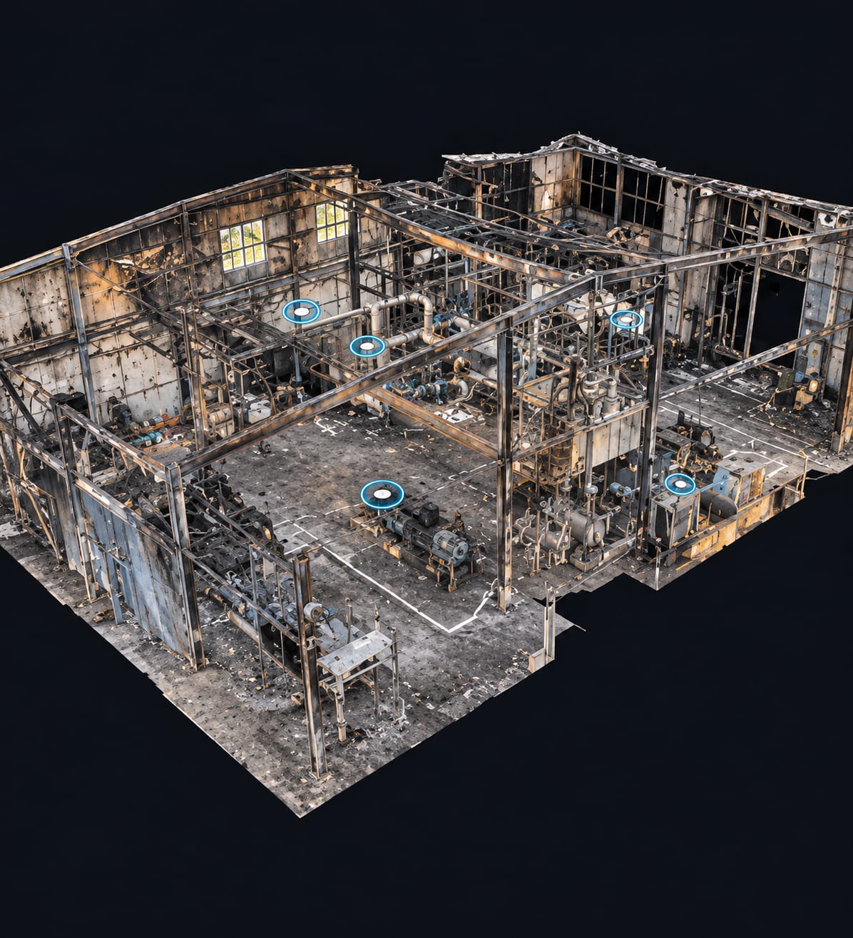
Original media should remain distinguishable from edited images, interpretive labels, illustrative reconstructions, and presentation graphics. File integrity procedures, permissions, retention, and formal chain of custody should be agreed upon with the investigative team when the material may be used as evidence.
The NIST-hosted technical guidance from the Organization of Scientific Area Committees emphasizes systematic documentation of evidence and careful forensic practices in fire and explosion investigations (OSAC Fire & Explosion Investigation Subcommittee). Spatial records can help, but they require the same attention to provenance and limitations as any other evidence collection method.
A Record That Can Survive the Cleanup
Cleanup, stabilization, and reconstruction are essential to recovering from an industrial incident. They also remove or alter features that a later reviewer may want to examine. The documentation team’s job is to collect the requested visual and spatial record while those features can still be safely observed.
For a fire or explosion scene, this means starting with a clearly defined investigative need, coordinating access, documenting critical equipment and structural relationships, identifying gaps in coverage, and protecting the original files. Detailed photographs may be sufficient for some assignments. Others warrant aerial mapping, interior 3D capture, or a combination of methods.
SterFlies provides aerial and ground-based site documentation to support professional review. The company’s role is to document physical conditions using methods appropriate to the assignment. Origin and cause findings, structural evaluations, process analysis, and legal conclusions remain the responsibility of the specialists qualified to make them.
A good model cannot tell an investigator what happened. It can help preserve the scene's appearance as it looked when the field team was finally able to document it.
Works Cited
Matterport. “Rimkus Utilizes Matterport to Streamline Forensic Consulting, Engineering Design, and Technical Services.” Matterport. https://matterport.com/industries/case-studies/rimkus-utilizes-matterport-streamline-forensic-consulting-engineering.
National Fire Protection Association. NFPA 921: Guide for Fire and Explosion Investigations. 2024 ed., NFPA. https://www.nfpa.org/codes-and-standards/nfpa-921-standard-development/921.
Occupational Safety and Health Administration. “Field Safety and Health Management System Manual: Chapter 23.” U.S. Department of Labor. https://www.osha.gov/shms/chapter-23.
Occupational Safety and Health Administration. “OSHA Technical Manual: Section V, Chapter 1.” U.S. Department of Labor. https://www.osha.gov/otm/section-5-construction-operations/chapter-1.
OSAC Fire & Explosion Investigation Subcommittee. Strengthening Fire and Explosion Investigation in the United States: A Strategic Vision for Moving Forward. National Institute of Standards and Technology, Apr. 2021. https://www.nist.gov/adlp/spo/organization-scientific-area-committees-forensic-science/strengthening-fire-and-explosion.
Spear & Lancaster. “Don’t Wait: Navigate Process Safety Management (PSM) Standards Amid Pending Regulatory Updates.” Spear & Lancaster. https://jespear.com/dont-wait-navigate-process-safety-management-psm-standards-amid-pending-regulatory-updates/.