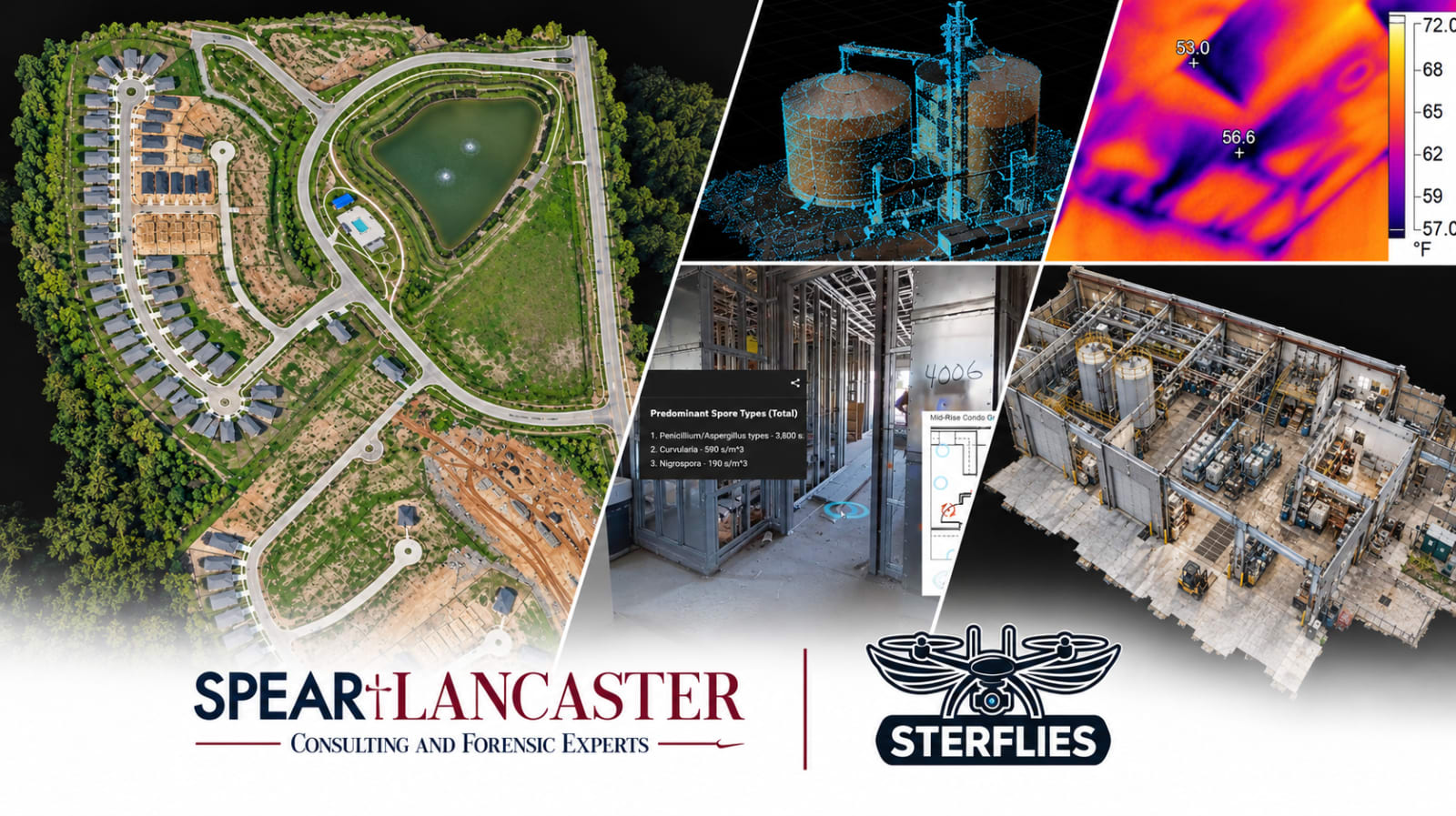
SterFlies, a San Antonio-based technical field documentation company, is now a division of Spear + Lancaster. The addition brings aerial mapping, thermal imaging, 3D scanning, and other reality capture methods into closer alignment with the firm’s established safety, industrial hygiene, and investigation work. The objective is straightforward: document a site thoroughly while access is available, then make that record useful for later review.
For an investigation, the first visit to a location can be one of the few, if not the only, opportunities to observe conditions as they exist. Equipment may be moved, repairs may begin, time has passed, and the site itself may change. Photographs remain essential, but they show only what was in the frame. SterFlies provides additional ways to capture relationships among rooms, structures, terrain, and other physical features, so later review doesn't rely solely on notes and isolated images.
How SterFlies Began
SterFlies was founded in July 2024 by Sterling Spear, driven by an interest in photogrammetry and drone mapping. What began as a way to turn drone flying into a career quickly evolved into a broader interest in the information a site can yield. By processing overlapping photos, Sterling could create 3D models, 2D maps, and terrain representations that revealed far more than a collection of individual aerial images.
Early assignments for Jerome E. Spear, a founding partner of Spear + Lancaster and Sterling’s father, demonstrated how those tools could support real investigative work. Mapping and reality capture added visual context to cases that would otherwise have relied heavily on conventional photographs, video, field notes, and observations from an initial visit. Over time, the work expanded beyond drones to include ground scanning, thermal imaging, and more systematic site documentation.
Today, the drone is just one of several tools. The focus is on selecting a practical method for the conditions being documented and producing a record that others can navigate, inspect, and understand.
Meet Sterling Spear
Sterling leads field documentation for the SterFlies division. Depending on the assignment, he may collect aerial photographs, record interior spaces with a 3D scanner, capture thermal images, or develop maps and models that put individual observations in context. He is an FAA Part 107 remote pilot and works with a range of aerial and ground-based capture systems.

Sterling is most interested in making a real place accessible again after fieldwork ends and in turning a real site into a digital scene. A virtual walkthrough can show how one room connects to another. A reconstructed 3D model can provide an overall view of a structure or outdoor work area. An annotated map can link a photograph, location, or observation to the part of the site it describes. He enjoys building these records because they let a reviewer go beyond simply looking at pictures.
Aerial Photography and Video
Aerial photographs and video help establish a site's broader context. On outdoor assignments, they can show the placement of structures, access roads, equipment, work areas, and surrounding terrain in ways ground photography often cannot. They can then collect more detailed photographs from relevant angles and elevations, subject to site conditions and safe flight operations.
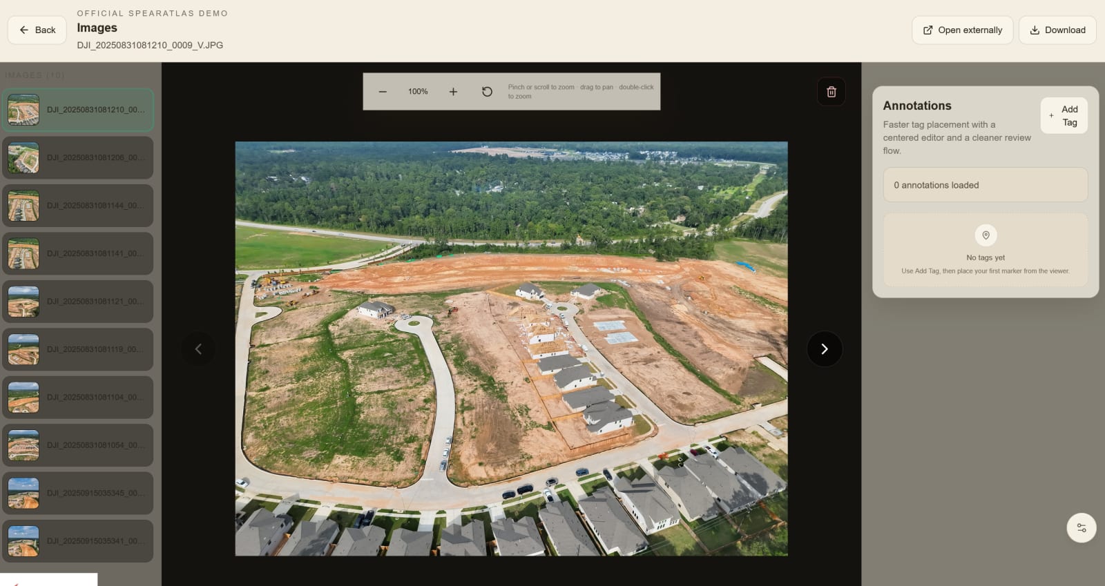
SterFlies uses aerial imaging at outdoor investigation sites and as part of broader documentation for construction and industrial locations. The same photographs can also serve as input for photogrammetry, allowing a series of overlapping views to be reconstructed into a 3D model. Aerial views do not replace ground-level detail, but the two can work together to make the site easier to understand.
Thermal Imaging
Thermal cameras record differences in apparent surface temperature rather than the visible color and texture captured by a standard camera. During indoor air quality and mold-related assignments, SterFlies has used aerial thermal imagery to document roof areas and identify temperature patterns that warrant closer examination. A handheld thermal camera can also provide additional ground-level views of building surfaces or equipment.
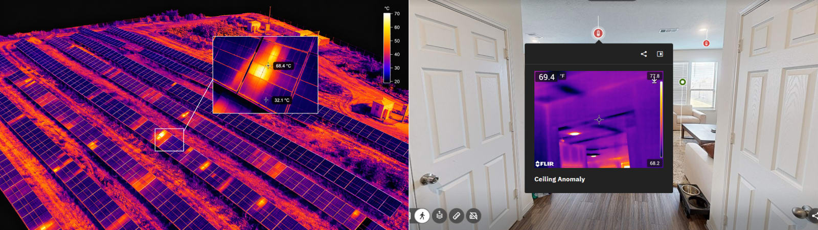
Thermal imaging can also be useful when a project requires documenting potential moisture-related conditions or unusual heat patterns in electrical equipment. These patterns require careful interpretation. Sun exposure, reflections, material properties, and operating conditions can affect what appears in a thermal image. A thermal image alone does not prove moisture, mold, or an electrical fault. Its value lies in recording a location and a condition that a qualified professional can evaluate alongside other evidence and testing.
3D Scanning and Virtual Walkthroughs
Not every site can be understood from above. Inside a building, the relationships among rooms, corridors, workspaces, and equipment can be as important as the exterior layout. Using the Matterport Pro3, SterFlies creates navigable spatial records of residential, commercial, and industrial properties. Reviewers can move through a captured space, revisit points of interest, and better understand where observations were made.
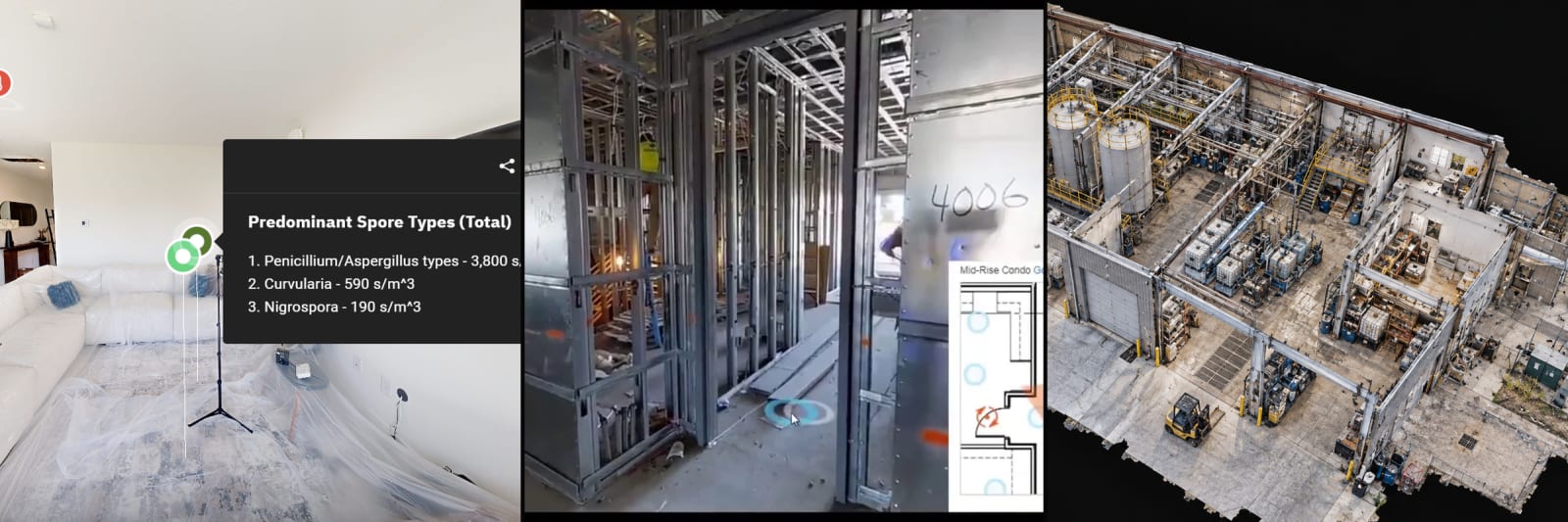
These records have already been used by Spear + Lancaster investigators for remote site reviews. That matters when an expert needs to revisit a room layout or verify the location of a feature after the original visit, especially when travel is difficult or the property has changed. Photographs, notes, and other relevant information can also be linked to the appropriate locations in the digital record.
Orthomosaic Maps, 3D Models, and Point Clouds
For larger outdoor areas, SterFlies can process overlapping aerial photographs into an orthomosaic. An orthomosaic is a continuous overhead image corrected for perspective and terrain, providing a maplike view of the site rather than a patchwork of separate photographs. It can help investigators understand the overall arrangement of structures, paths, equipment, and other features across a location. With appropriate control and verification, mapping products can also support defined measurement tasks. They are not a substitute for a licensed land survey when one is required.
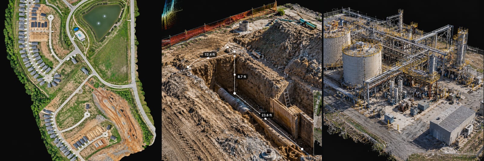
The same capture workflow may produce a textured 3D model or a point cloud. These outputs preserve different aspects of site geometry and help reviewers examine spatial relationships from multiple viewpoints. Sterling uses applications such as Pix4D, RealityScan, Matterport, and Blender to process, refine, and organize the resulting material. The deliverables depend on the assignment. Some cases call for a clear overhead map, while others benefit more from an interior walkthrough, a 3D reconstruction, or a combination of records.
Supporting Site Investigations and Expert Review
SterFlies has contributed documentation for assignments involving confined spaces, indoor air quality and mold assessments, trench collapse, and chemical exposure. These projects differ substantially, but the documentation question is often the same: What physical conditions should we record now so we can review them later with as much context as possible?
For a trench incident, the investigation may involve the excavation, nearby equipment, access points, and the surrounding work area. On a chemical exposure assignment, a facility's layout and the location of relevant areas may be important. During an indoor air quality assessment, a room-based walkthrough can help link observations and sampling locations to the space where they were collected. No single capture method fits every case, so the approach depends on the site and the investigation's needs.
SterFlies documents conditions. Safety professionals, industrial hygienists, engineers, investigators, and other qualified experts interpret those records and form discipline-specific technical opinions. That distinction is important. Reality capture is not meant to replace expert judgment. It gives those exercising that judgment a more complete, accessible picture of the place they are evaluating.
A New Chapter with Spear + Lancaster
As a division of Spear + Lancaster, SterFlies will support the firm’s work in workplace incident investigations, construction safety, industrial hygiene, fatalities, and other matters requiring detailed site documentation. It will also continue to accept independent documentation projects. Based in San Antonio, SterFlies serves clients throughout Texas and can travel elsewhere for assignments.
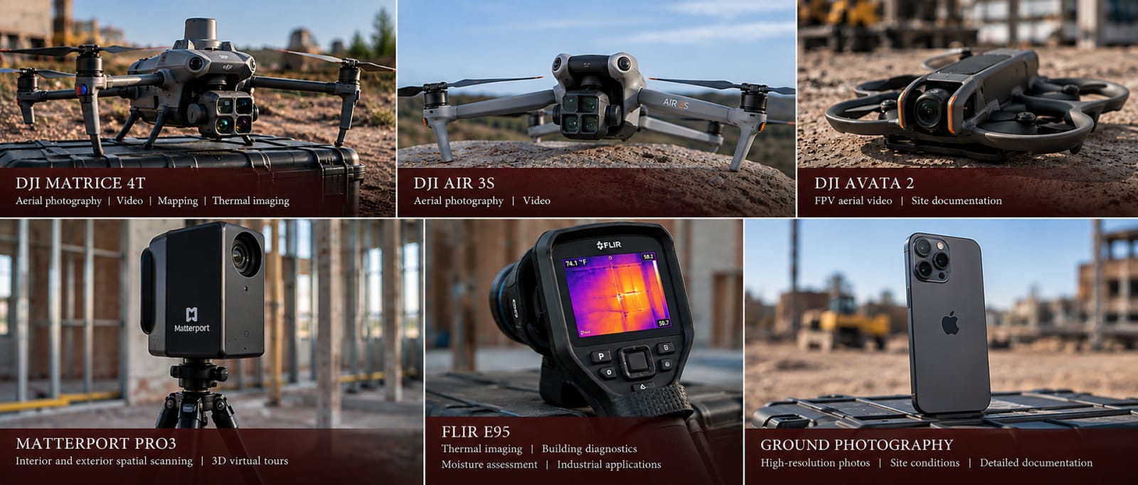
The equipment includes the DJI Matrice 4T, DJI Air 3S, DJI Avata 2, Matterport Pro3, FLIR E95, and conventional ground photography tools. Each serves a distinct purpose, and not every assignment requires all of them. The decision starts with what needs to be documented, not with a particular device.
“I’m excited to join the Spear + Lancaster team and work alongside professionals who have spent their careers helping people understand safety and workplace conditions,” Sterling said. “My goal is to provide useful, detailed site documentation to support the team with the cases they take on.”
The next chapter gives SterFlies an opportunity to support additional investigations while continuing to improve how field information is captured, organized, and shared. Technology will continue to evolve. The purpose of the work will remain the same: to create a reliable visual record of a site while there is still an opportunity to document it.