.png)

FAA Part 107 Certified
OSHA 10-Hour Construction Safety
Elevate
your vision with SterFlies
Reliable aerial and ground data and imagery for clear, accurate site documentation.
Let’s Get Started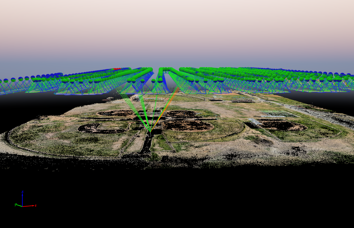
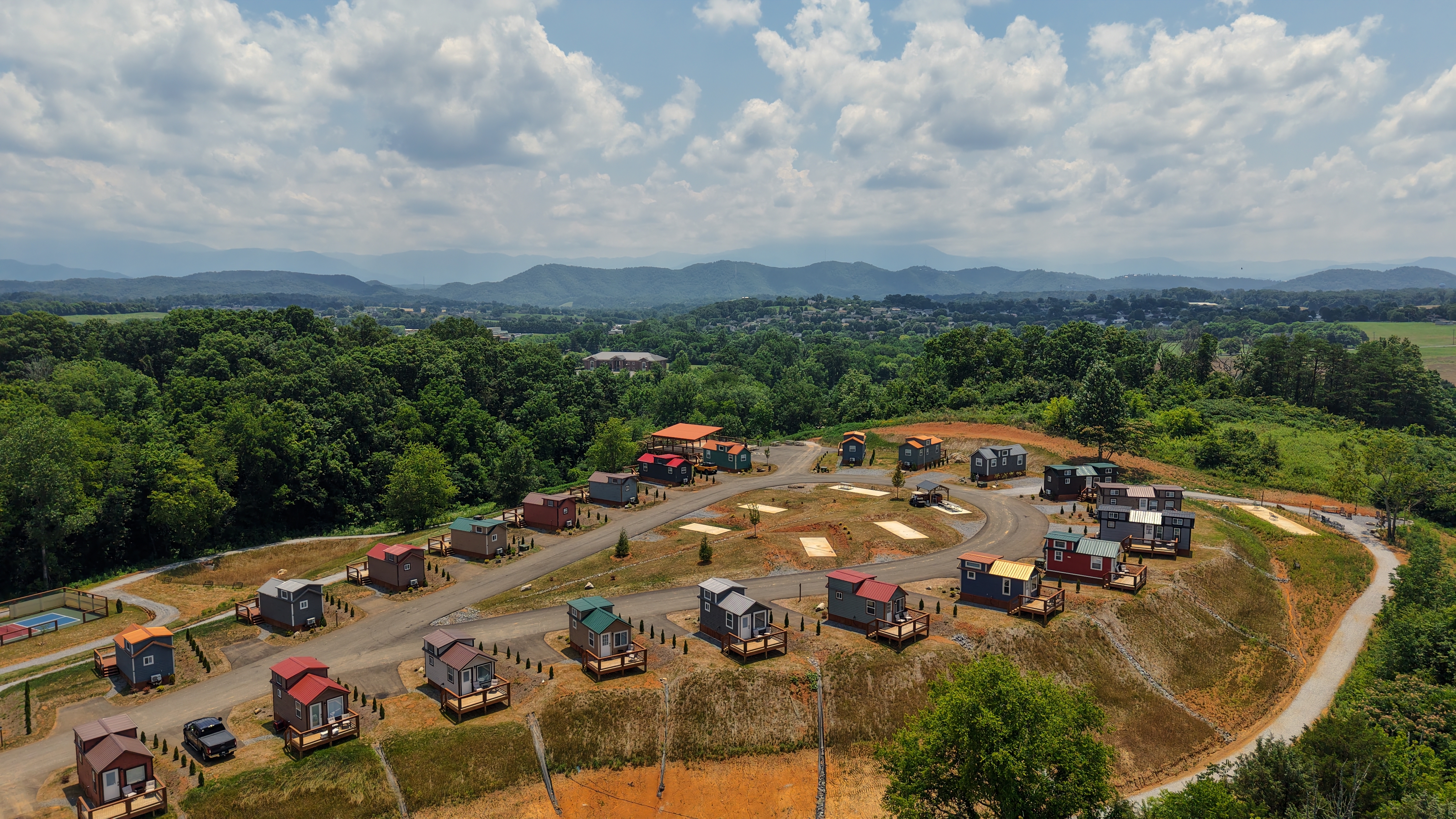
Data Captured
for Your Current Project
Aerial and ground-based scanning using drones and 3D capture to document sites in accurate 2D and 3D.
Read more!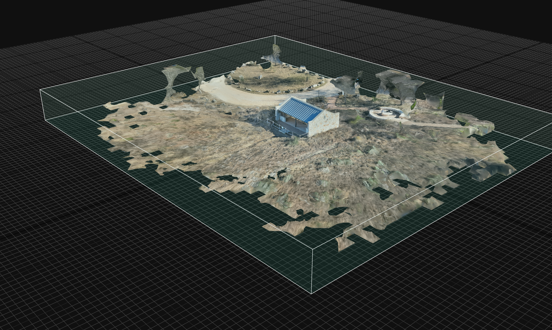
Site Conditions
Captured as Measurable 3D Data
We capture sites as structured 3D data rather than simple imagery, producing accurate visual records that can be measured, revisited, and referenced long after site conditions change.
Read more!Full Site Context
Interior and Exterior Connected
We document sites as one navigable spatial record, combining exterior aerial capture with interior 3D scanning to preserve full context across spaces, structures, and conditions.
See How It WorksWatch This Short Infomercial
SERVICING SAN ANTONIO & SURROUNDING AREAS
With statewide coverage available for large‑scale projects.
- • San Antonio Metro (Bexar, Comal, Guadalupe, Kendall)
- • Austin–San Marcos corridor
- • South & Central Texas

Proudly Specializing In
Forensic Site Documentation
Site-Reconsctruction
Thermal Inspections
Tell Us About Your Project
Tell us what you’re looking for—whether it’s a specific project, data requirement, or marketing idea. We’ll help shape the perfect aerial shoot to match your goals.
We’ll Schedule a Flight
Once we’ve got the details, we’ll schedule your drone flight with a certified pilot. We come to you—on time, every time.
Download Your Aerial Imagery
Your visuals are edited and delivered within 7 business days of the shoot—ready for download and ready to use.
Sign up to our Newsletter!
* indicates required