The Problem With Casual Photos
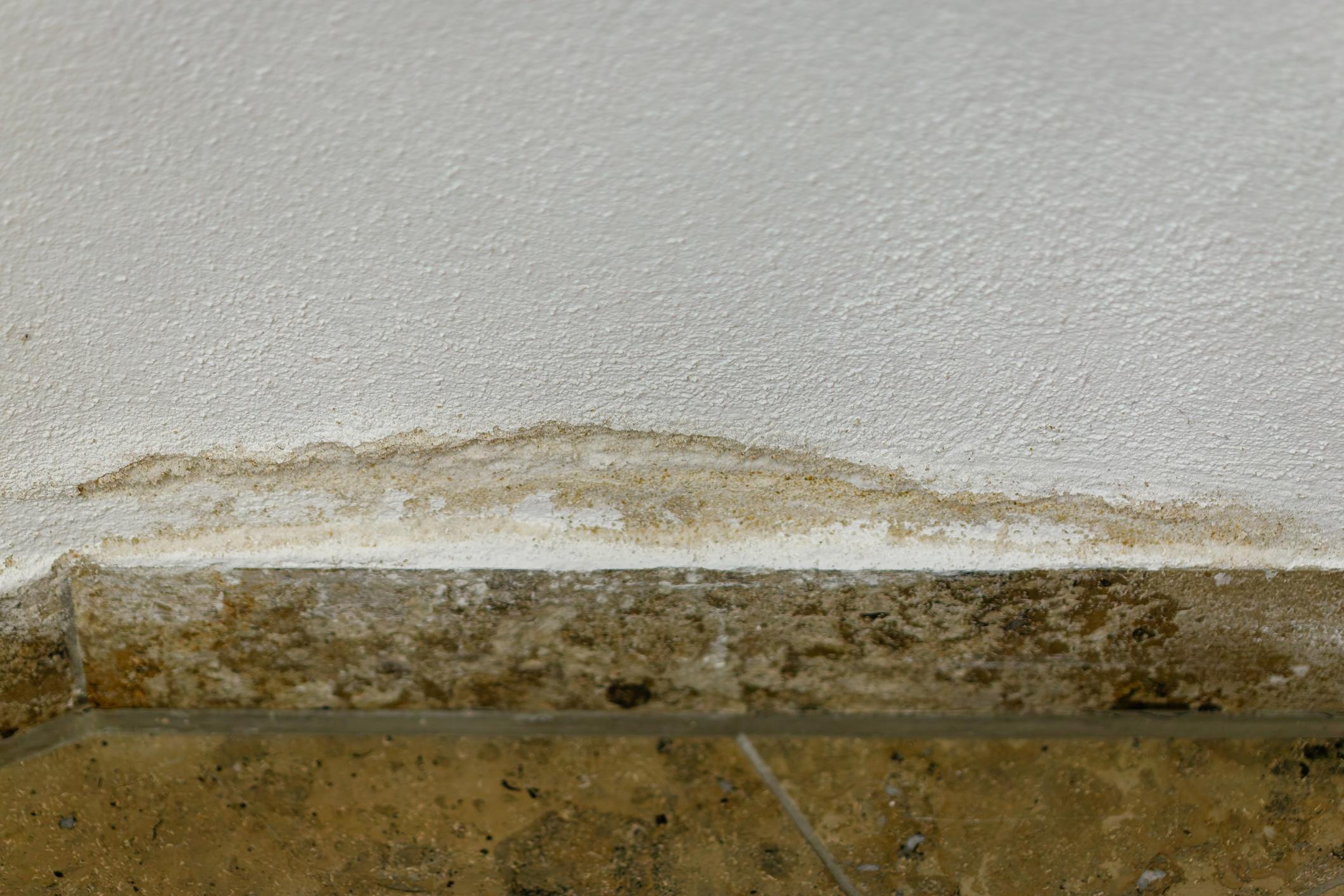
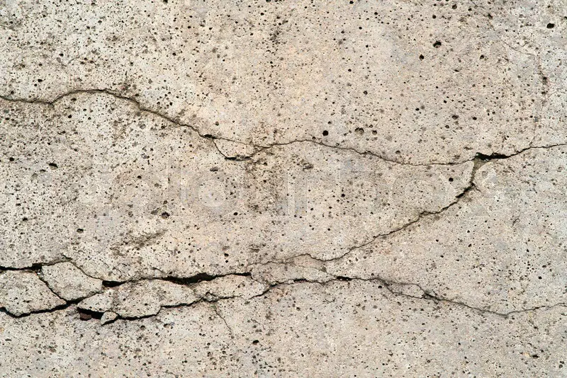
Casual photos are easy to capture, but they come with serious limitations. They often lack spatial context. A close up image of a crack, stain, or surface condition tells you very little about where it exists within the broader site. Without reference points, scale, or orientation, it becomes difficult for anyone who was not physically present to understand what they are looking at.
They are subjective by nature. Photos are taken based on what someone thought was important at the time. Anything not noticed, misunderstood, or deemed insignificant simply goes undocumented. Even when photos are plentiful, they usually do not provide a consistent structure that ties everything together.
Once a site changes, casual photos become difficult to verify. There is often no reliable way to confirm the exact location a photo was taken, how it relates to other areas, or whether nearby conditions contributed to the issue being discussed. In short, casual photos capture moments. They do not preserve reality.
What Forensic Site Documentation Actually Means
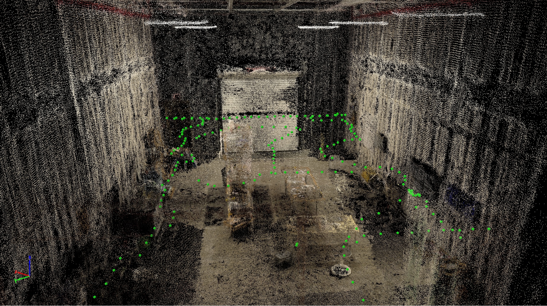
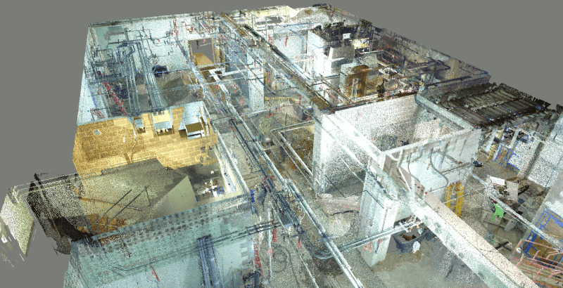
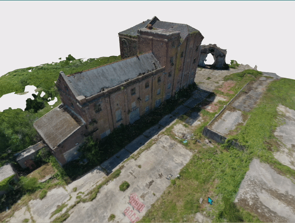
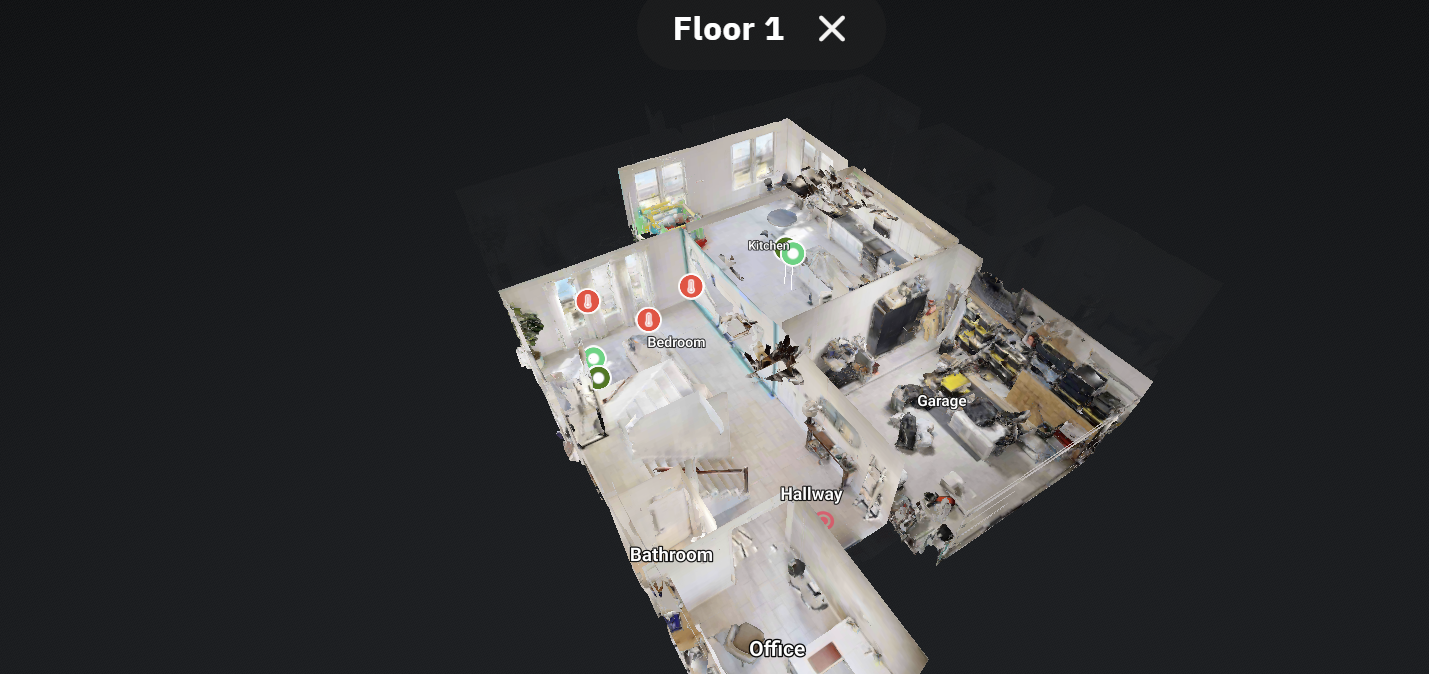
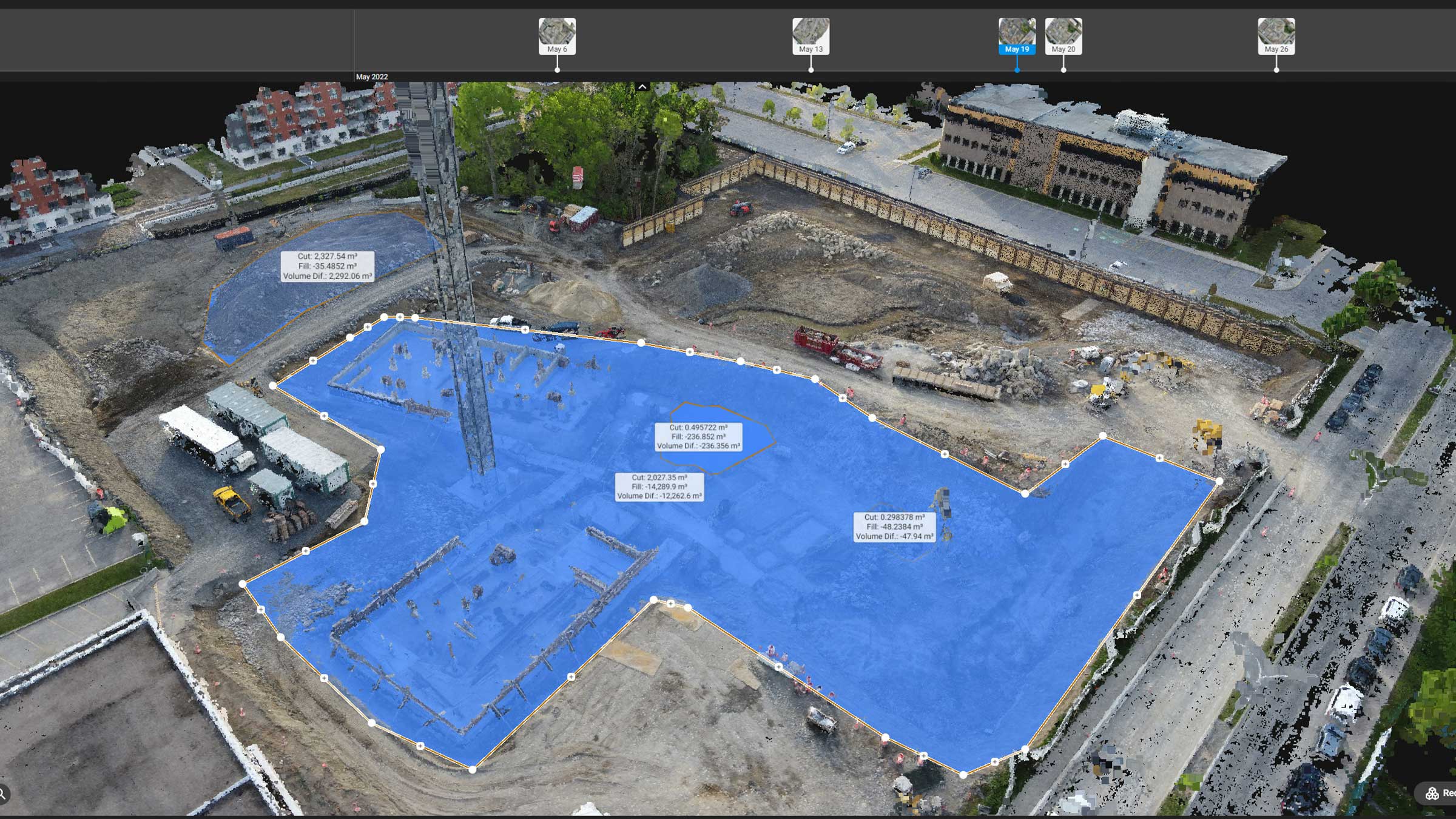
Forensic site documentation is the practice of creating a spatially accurate, comprehensive record of a site that can be analyzed long after physical access is no longer possible. Instead of isolated images, the output is a measurable digital representation of the site itself.
This typically includes high overlap aerial imagery, ground based scanning, and structured capture workflows that allow the site to be reconstructed as a navigable 3D environment. Every image, scan, and data point exists within a shared coordinate space, preserving scale, distance, and relationships between elements.
Rather than asking what a single photo shows, the question becomes where exactly a condition is located and how it relates to everything around it. That shift changes how professionals interpret evidence, how teams communicate, and how decisions get made.
Spatial Accuracy Is the Difference Maker
Spatial accuracy is what separates documentation from evidence. In forensic site documentation, imagery can be processed into orthomosaics, point clouds, and 3D models that are geometrically correct, not visually approximated. Distances can be measured. Locations can be verified. Relationships between features can be preserved and reviewed later with confidence.
This allows professionals to revisit the site virtually and answer questions that were never asked at the time of capture. Where was a condition located relative to a structure, pathway, or system. How far apart were two features. What existed nearby that may have contributed to the issue being discussed. These are questions photos alone simply cannot answer.
If you publish orthomosaic outputs as part of your documentation workflow, you can also link to your dedicated orthomosaic explainer for deeper context. Learn what an orthomosaic is.
Context Over Time Matters
Sites are not static. They change constantly. Materials are removed, surfaces are altered, systems are repaired, and environments evolve. Once those changes occur, the original conditions are often lost forever.
Forensic site documentation preserves a time stamped snapshot of reality, allowing stakeholders to see what existed before alterations were made. This becomes invaluable when evaluating responsibility, understanding causation, or reconstructing events accurately.
Without this level of documentation, teams are left relying on memory, assumptions, and incomplete visual records. That gap is where confusion grows and disputes thrive.


Why This Matters in High Stake Situations
In construction defect matters, environmental assessments, safety incidents, and legal disputes, clarity matters more than opinion. Forensic site documentation provides a neutral, objective record that can be reviewed by engineers, consultants, attorneys, and decision makers without needing to physically return to the site.
Instead of debating what might have been present, teams can point to a shared visual and spatial reference that everyone can evaluate independently. This reduces misinterpretation, strengthens analysis, and supports informed decisions based on actual conditions, not recollections.
Why Photos Alone Will Never Be Enough
Photos are still useful. They capture details, textures, and specific conditions. But without spatial structure, photos are fragments of information floating without context.
Forensic site documentation brings those fragments together into a coherent whole. It transforms images into data, sites into digital records, and documentation into something that can stand up over time. That is the difference between having pictures and having proof.
Want a site record you can revisit from anywhere
SterFlies creates reliable aerial and ground based documentation that preserves site context for construction, environmental health, and high stake decision making.