Volumetric Data Explained: Aerial Insights for Smarter Site Decisions
By Jerome Sterling
In the construction and aggregate sectors, decision-making relies heavily on precise and reliable data. One increasingly popular method is aerial volumetric analysis—using drones to generate cut & fill reports that quantify exactly how much material needs to be moved, added, or removed.
What is Volumetric Data?
Volumetric data involves measuring the volume of materials—such as soil, rock, or gravel—present on a site. It’s essential for planning earth-moving operations to level terrain or achieve specific elevation goals, and gives stakeholders a quantitative basis for accurate project planning.
Understanding Cut and Fill Reports
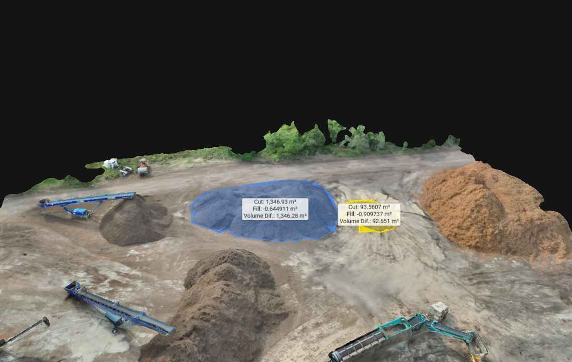
Cut and fill reports detail exactly how much material must be excavated (“cut”) or added (“fill”) to meet a project’s design specifications.
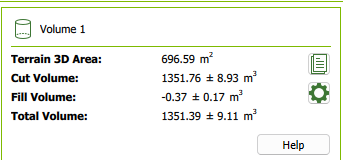
- Cut Volume: Total material to be removed from the site.
- Fill Volume: Material required to raise areas to grade.
- Net Volume: Cut minus fill—positive means surplus, negative means a shortage.
Cut and fill reports begin by comparing two digital terrain models: the existing ground surface and the engineered or design surface. The “cut volume” is calculated wherever the design surface lies below the existing ground—this tells you exactly how much material must be excavated to reach grade. Conversely, the “fill volume” quantifies all the spots where the design surface sits above the existing terrain, indicating how much additional material needs to be brought in. By subtracting fill from cut, you arrive at the “net volume,” which shows whether you have a surplus of excavated material that can be reused onsite or if you need to haul in extra fill. These metrics are critical for budgeting earthwork contracts, planning haul routes, sizing equipment, and minimizing waste: accurate volumetric calculations can reduce material over‐ordering by up to 20% and cut project costs by ensuring crews know precisely how much soil, rock, or gravel they’ll handle—before a single dump truck rolls onto the site.
The Rise of Aerial Volumetric Analysis
Traditional ground surveys can be slow, costly, and hazardous. Drone‐based surveys have transformed volumetric data collection—making it faster, safer, and more accurate.
- Rapid Data Collection: Capture a full site in minutes.
- High Accuracy: Generate precise 3D models with advanced sensors.
- Cost‐Efficient: Reduce waste, over‐ordering, and overruns.
- Enhanced Safety: Keep personnel out of hazardous areas.
As drone hardware and processing algorithms have matured, aerial volumetric analysis has emerged as a powerful alternative to traditional survey techniques. Modern UAVs equipped with high-resolution cameras, LiDAR, or multispectral sensors can fly a fully programmed grid over a site in minutes—capturing thousands of overlapping images that specialized software stitches into dense point clouds and detailed 3D surface models. By comparing these digital terrain models against design baselines, engineers calculate cut and fill volumes with centimeter-level accuracy, turning what once took days of ground-based measurements into a matter of hours. Cloud-based processing further accelerates the workflow—automatically handling large datasets, generating interactive maps, and instantly sharing results with project teams and stakeholders. This not only slashes surveying costs and material waste but also enhances safety by keeping personnel out of hazardous areas. As a result, industries from construction and mining to environmental management and agriculture now leverage drone-driven volumetric insights to streamline planning, optimize resource allocation, and maintain tighter control over schedules and budgets.
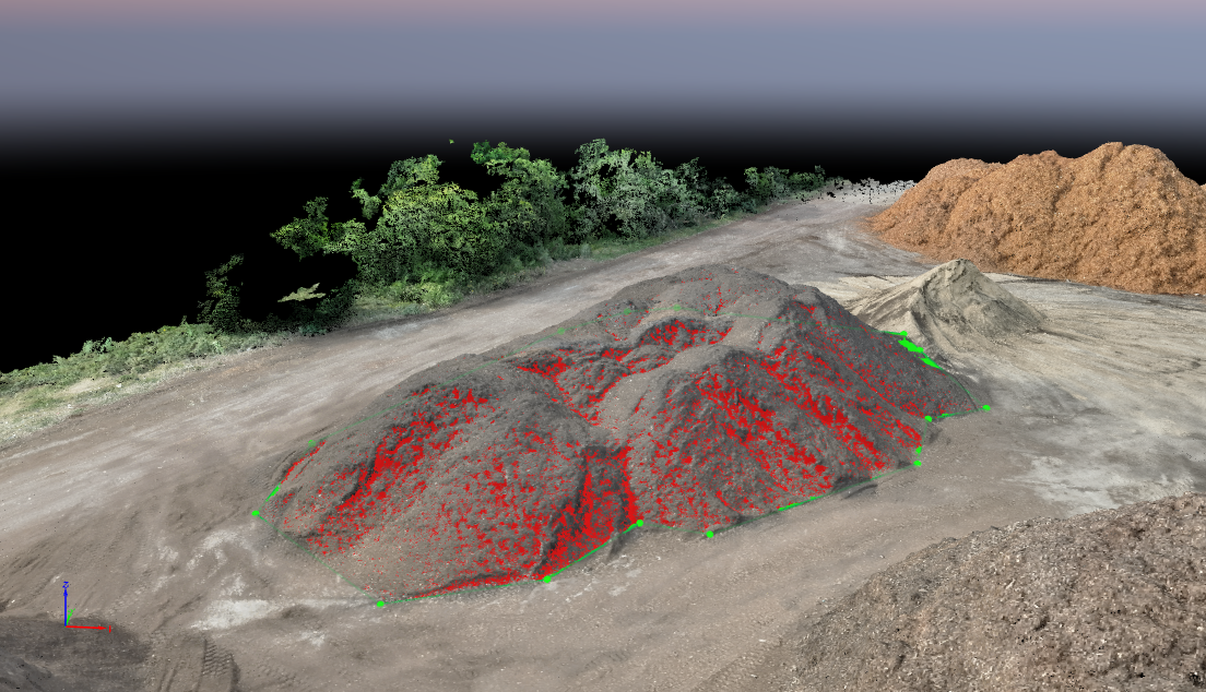
How Drone-Based Volumetric Analysis Works
Volumetric data starts with a structured aerial survey—typically a drone flying a precise grid pattern to capture hundreds or thousands of overlapping images of the site. These photos are fed into photogrammetry software to build an accurate 3D surface model of the existing terrain. By comparing this “as-built” model against the project’s design or baseline elevation plan, you compute exact volumes of material above (cut) or below (fill) the target grade. Because modern drone sensors and ground control points can achieve sub-inch accuracy, these volumetric measurements rival traditional surveying methods—but at a fraction of the cost and time. Beyond single snapshots, repeated volumetric surveys let you monitor stockpile inventory, track site progress, verify contractor pay-applications, and even detect unexpected settlement or erosion over time—making volumetric data the backbone of truly data-driven earthworks planning.
- Flight Planning: Grid the site for complete coverage.
- Image Acquisition: Shoot overlapping, high-resolution photos.
- Data Processing: Build accurate 2D & 3D terrain maps.
- Volumetric Calculation: Compute exact cut & fill volumes.
Real-World Applications
Volumetric reports deliver critical, real-world insights across a range of industries—construction managers can track earth-moving progress in near real-time to ensure projects stay on schedule and budget; mining and aggregate companies rely on precise stockpile measurements to optimize inventory and reduce shrinkage; environmental consultants use cut & fill data to model erosion risk, landfill capacity, and site remediation plans; civil engineers integrate volumetric analyses into earthwork contracts to accurately bid and verify quantities; and insurance adjusters leverage aerial volume assessments to substantiate loss claims quickly and objectively. By turning raw drone data into clear, quantified metrics, volumetric reporting empowers smarter decision-making, tighter cost control, and enhanced safety on every project.
Making Smarter Decisions Through Aerial Data
Precise volumetric insights drive accurate budgeting, optimal resource allocation, risk mitigation, and streamlined operations—leading to more successful project outcomes.