Thermal Imaging 101: How to Spot What the Eye Can’t See
By Jerome Sterling — Chief Pilot
Our eyes are powerful, but they’re limited. They operate within the visible light spectrum — meaning anything outside that range is invisible without the right tools.
Thermal imaging changes that. By capturing infrared radiation, drones equipped with thermal sensors can “see” temperature differences, revealing patterns, risks, and inefficiencies that standard cameras — and human eyes — completely miss.
In industries like solar, construction, utilities, and public safety, this ability translates directly into time saved, hazards avoided, and money retained.
1. The Science Behind Thermal Imaging
Thermal cameras work by detecting infrared energy emitted by objects. Every object above absolute zero (-273.15°C / -459.67°F) emits infrared radiation, and the hotter the object, the more radiation it emits.
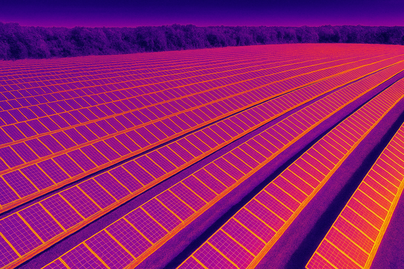
Unlike traditional cameras, which create images from visible light, thermal sensors translate temperature differences into a color‑coded image called a thermogram:
- Hotter areas appear as bright yellow, orange, or white.
- Cooler areas appear as purple, blue, or green.
Mounted on drones, these sensors provide a comprehensive aerial perspective, allowing large‑scale inspections quickly and safely.
2. Understanding Emissivity — The Key to Accurate Thermal Readings
One of the most important — and often overlooked — factors in thermal imaging is emissivity.
What is emissivity? It’s a measure of how effectively a material emits infrared radiation compared to a perfect “blackbody” emitter (which has an emissivity of 1.0).
Why it matters:
- High‑emissivity materials like wood, brick, and matte paint surfaces give more accurate temperature readings.
- Low‑emissivity materials like shiny metals reflect more infrared energy than they emit, which can cause misleading readings.
- Environmental factors like moisture, dirt, or coatings can alter a surface’s emissivity.
Example: If you scan a shiny metal roof with a thermal camera, it might show a “cold” spot simply because it’s reflecting the sky, not because the material itself is actually cold.
Best practices in drone thermal work:
- Know the emissivity of the materials you’re inspecting.
- Adjust the camera’s emissivity settings accordingly.
- Avoid interpreting results without context — always consider surrounding materials and conditions.
3. Common Use Cases Across Industries
Solar Energy
Thermal imaging quickly identifies faulty or underperforming solar panelsby spotting “hot spots” caused by electrical or mechanical failures.
- Impact: Detecting defects early can prevent efficiency loss worth tens of thousands of dollars annually for large solar farms.
Construction
Thermal drones help detect insulation gaps, air leaks, and water intrusionin buildings.
- Impact: Prevents costly rework, reduces energy loss, and supports compliance with energy‑efficiency standards.
Electrical Utilities
Thermal imaging spots overheating transformers, loose connections, and failing components before they cause outages or fires.
- Impact: Reduces downtime and prevents expensive emergency repairs.
Roofing
Thermal scans reveal moisture trapped beneath roofing membranes, pinpointing damage without destructive inspection.
- Impact: Allows targeted repairs, saving thousands in unnecessary replacement costs.
Public Safety
Thermal drones are invaluable for search and rescue, detecting heat signatures of missing persons in dense terrain or at night.
- Impact: Saves lives by drastically reducing search times.
4. Real‑World Savings Examples
- Solar Farm ROI: A 50MW facility detected 2% panel failure using thermal drones. Repairs restored efficiency, recovering an estimated $120,000 in lost annual revenue.
- Commercial Building Audit: A thermal roof inspection found water intrusion affecting only 15% of the surface — avoiding a full $250,000 roof replacement.
- Electrical Substation: Early detection of a failing transformer coil prevented an unplanned outage, saving $40,000 in emergency repairs and downtime.
5. Why Use Drones for Thermal Imaging Instead of Ground Inspections?
- Coverage: Scan large areas quickly — ideal for solar farms, construction sites, and power lines.
- Safety: No need for workers to enter hazardous zones or work at heights.
- Speed: Inspections that take days on foot can be done in hours.
- Perspective: Aerial vantage points reveal issues invisible from ground level.
The Bottom Line
Thermal imaging is more than just a “cool” technology — it’s a profit‑saving and safety‑enhancing tool. By revealing what’s invisible to the naked eye, it helps companies save money, prevent failures, and improve safety.
In an era where efficiency, safety, and sustainability are top priorities, the ability to see the unseen is no longer optional — it’s a competitive advantage. And with drones, that advantage is more accessible than ever.