
Why traditional documentation breaks down at scale
Most professional workflows still depend on familiar tools: ground photos, written notes, and people’s recollection of what happened. These tools are valuable, but they are limited by viewpoint and completeness. Ground photos tend to isolate conditions. Notes compress complex environments into summaries. Recollection becomes less reliable as time passes and narratives form.
The problem usually shows up after the site changes. Construction progresses. Materials move. Areas get repaired or remediated. Access becomes restricted. When that happens, teams are forced to make decisions with partial context. That is where disagreements grow and defensibility weakens, not because professionals are careless, but because the environment was never preserved as a coherent whole.
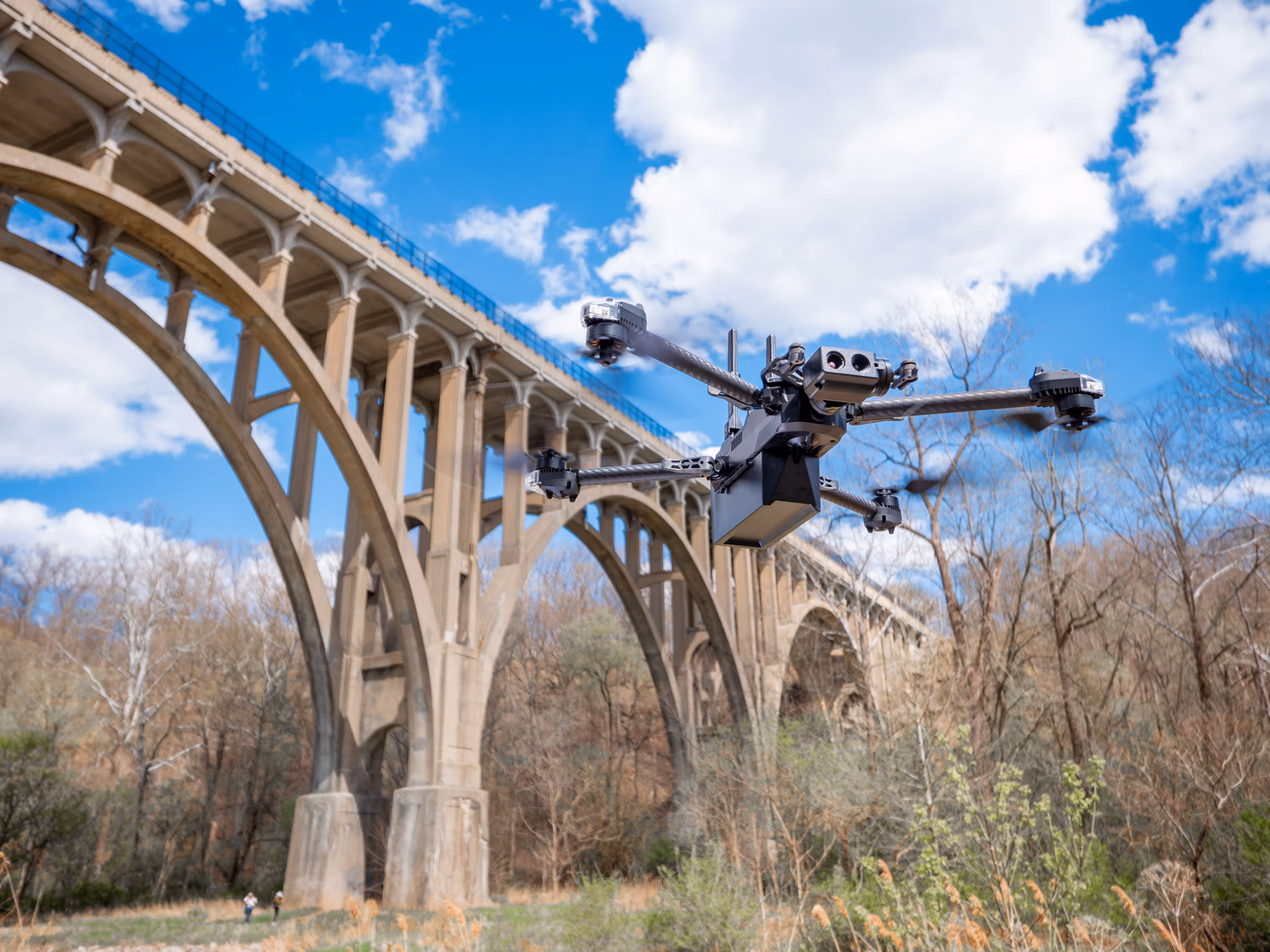
Drones are not cameras anymore, they are data systems
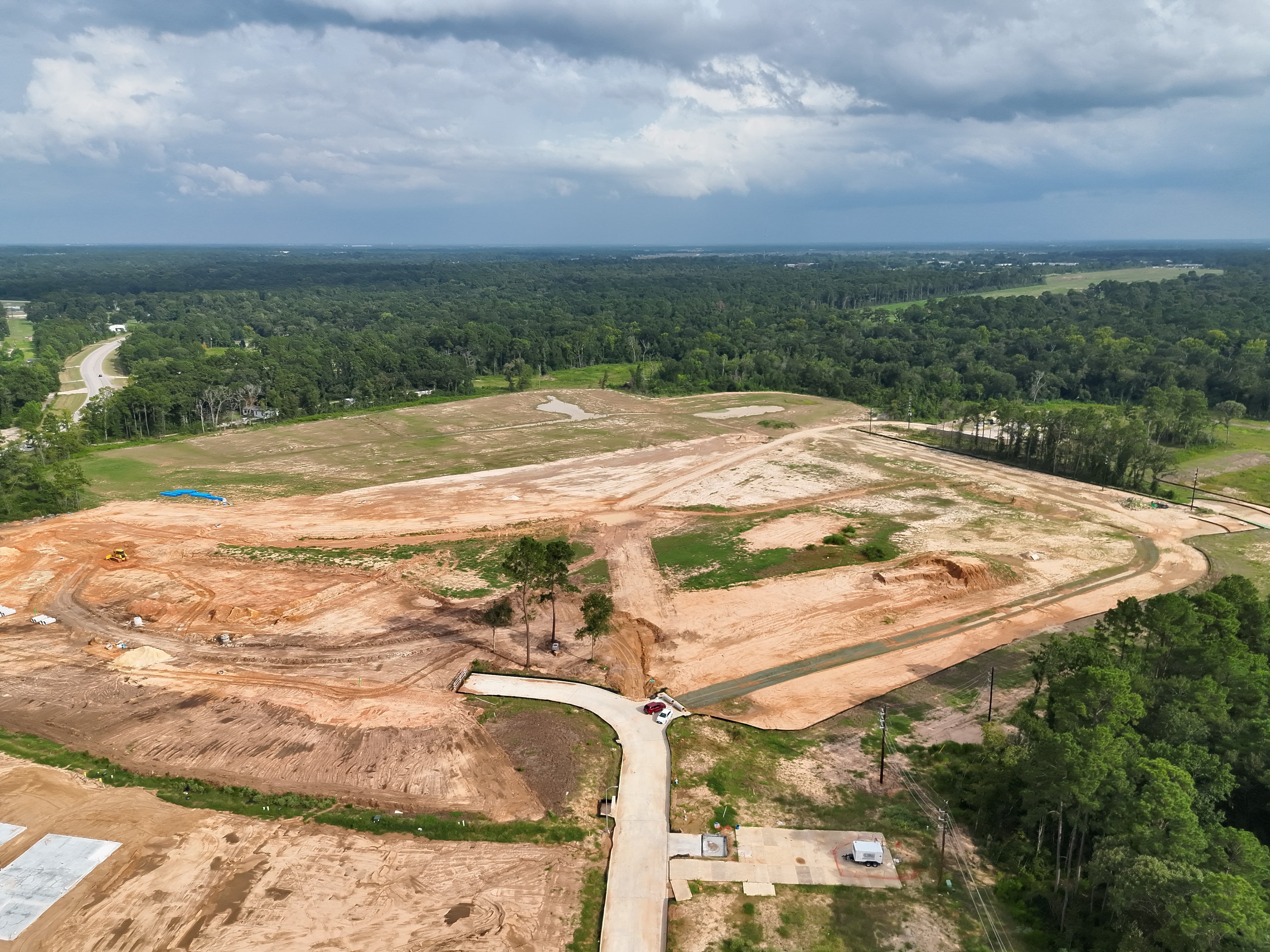
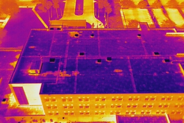
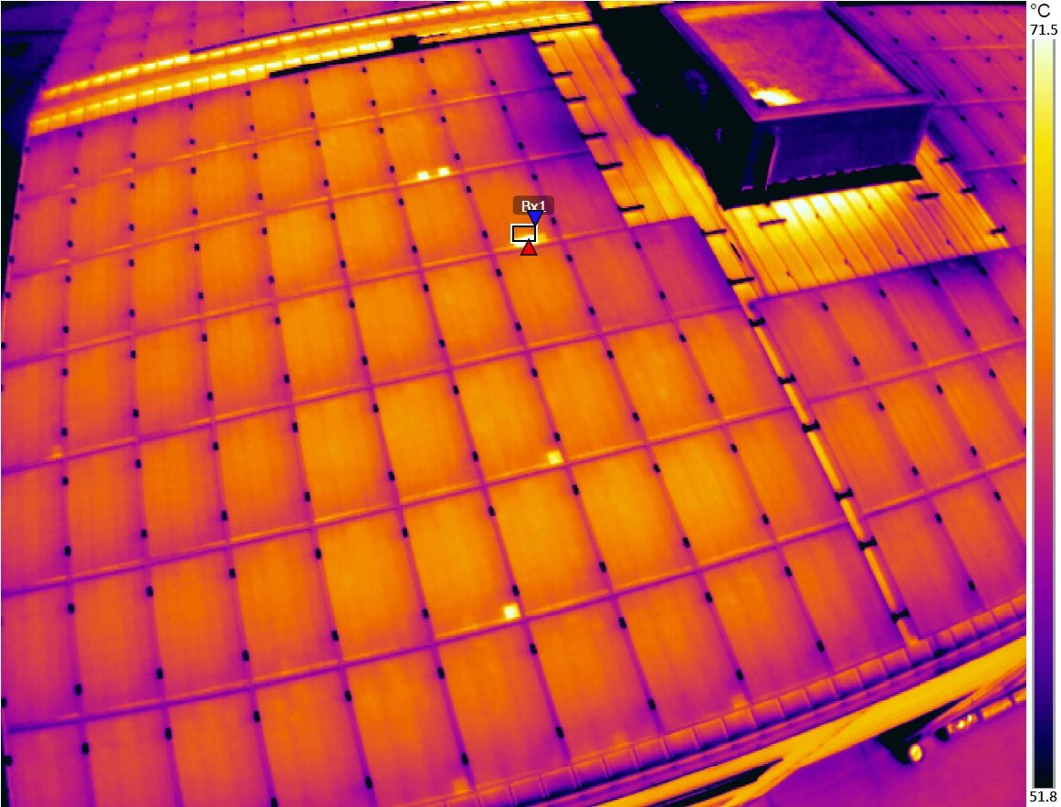
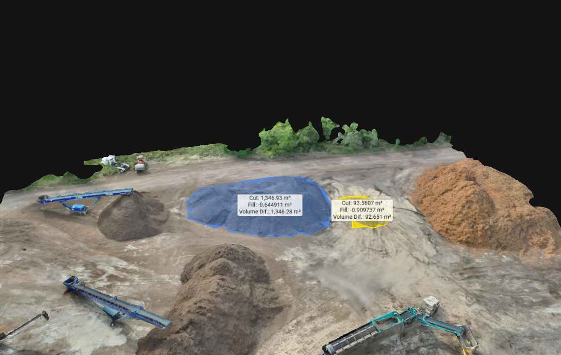
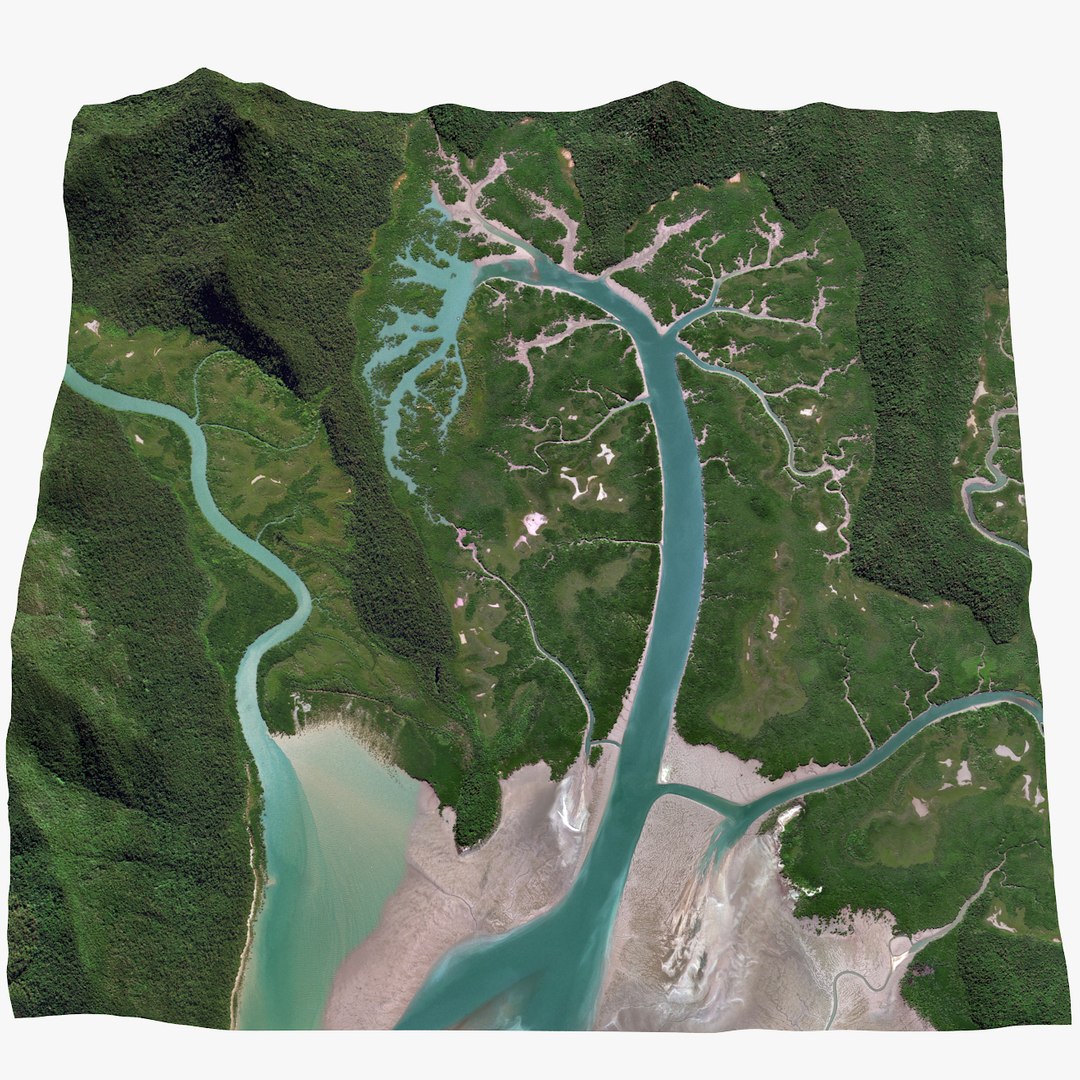
The most valuable drone programs are built around deliverables that support measurement and navigation, not just visuals. Orthomosaics provide scaled reference. 3D reconstructions preserve geometry and relationships. Thermal overlays introduce an additional layer of insight for moisture, heat loss, and electrical anomalies. When these outputs are captured with consistent coverage and a clear intent, the drone becomes a repeatable data acquisition system.
This is why drone integration is accelerating in high consequence workflows. It reduces reliance on interpretation by replacing fragmented snapshots with structured spatial records.
How this applies to SterFlies
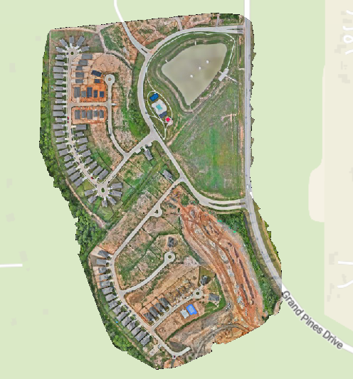
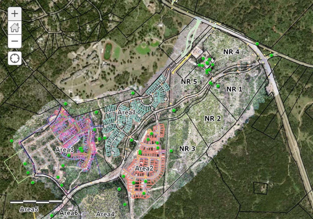
SterFlies is built around structured site documentation, not one off flights. The goal is to preserve a site in a way that supports review, collaboration, and defensibility. That means capturing with completeness in mind, prioritizing consistent angles and coverage, and delivering outputs that help stakeholders understand where conditions exist, how they relate to surrounding systems, and what changed over time.
When documentation is treated as a system, it becomes useful to multiple audiences at once. A project manager can verify progress. An industrial hygiene consultant can reference sampling locations in context. An attorney can preserve a site before alteration and reduce risks of liability. A property owner can reduce ambiguity during claims or disputes. The drone is simply the collection tool. The deliverable is the structured dataset and the clarity it creates.
SterFlies positioning
SterFlies focuses on forensic style documentation. The value is not just capture, it is repeatability, spatial context, and deliverables that remain useful after the site changes.
Growing use cases across industries
Drone workflows are expanding because most industries share the same pain point: teams need better visibility into physical environments than ground based documentation can reliably provide. When drones become part of the workflow, documentation shifts from selective to comprehensive.
The pattern is consistent. The industries that benefit most are the ones where context matters and where conditions change quickly. When teams can review a site remotely with orientation intact, the quality of decisions improves and the cost of uncertainty drops.
The real advantage is systematic capture, not emergency capture
Many organizations first adopt drones reactively, usually after a dispute, a surprise condition, or an incident. That can still be valuable, but the strongest results come from planned capture phases. Systematic capture creates baselines, makes change detection possible, and prevents the most common documentation failure: gaps that cannot be reconstructed later.
In construction, that can mean repeat flights at predictable milestones. In solar, it can mean routine thermal sweeps. In environmental work, it can mean baseline mapping before disturbance and follow up mapping after key changes. When capture becomes routine, the site becomes reviewable at any point in its history.
To wrap this up
Drone integration is becoming a standard because it closes a gap that professionals have lived with for years. It preserves site reality with context, scale, and measurability. As projects become more complex and scrutiny increases, documentation must evolve. The organizations that treat drone capture as a structured layer of the workflow will operate with clearer records, stronger communication, and better defensibility when questions arise later.
SterFlies exists to deliver that clarity. Not to simply fly drones, but to preserve environments in a way that remains useful after the site changes and the moment is gone.
Want drone documentation that is built for defensibility and decision making
SterFlies provides structured aerial documentation and spatial deliverables for construction, environmental work, infrastructure, energy, and litigation support.