Why traditional evidence often breaks down under dispute pressure
The classic evidence package is familiar. Photographs, written reports, sketches, and witness statements. These still matter, but they were never designed to preserve spatial reality with precision. A photograph captures a frame from one angle. A note captures an observation filtered through perception. A sketch captures an interpretation. Even when everyone is operating in good faith, these tools leave room for disagreement because they do not preserve the environment as a whole.
Disputes amplify those gaps. Months pass. Site access becomes restricted. Conditions evolve. Opposing narratives become harder to reconcile because the shared reference point is weak. That is exactly where reality capture begins to influence case strategy.
How 3D reality capture changes the strategy, not just the visuals
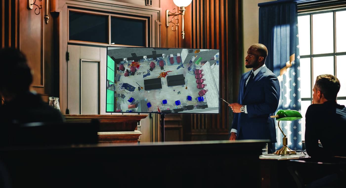
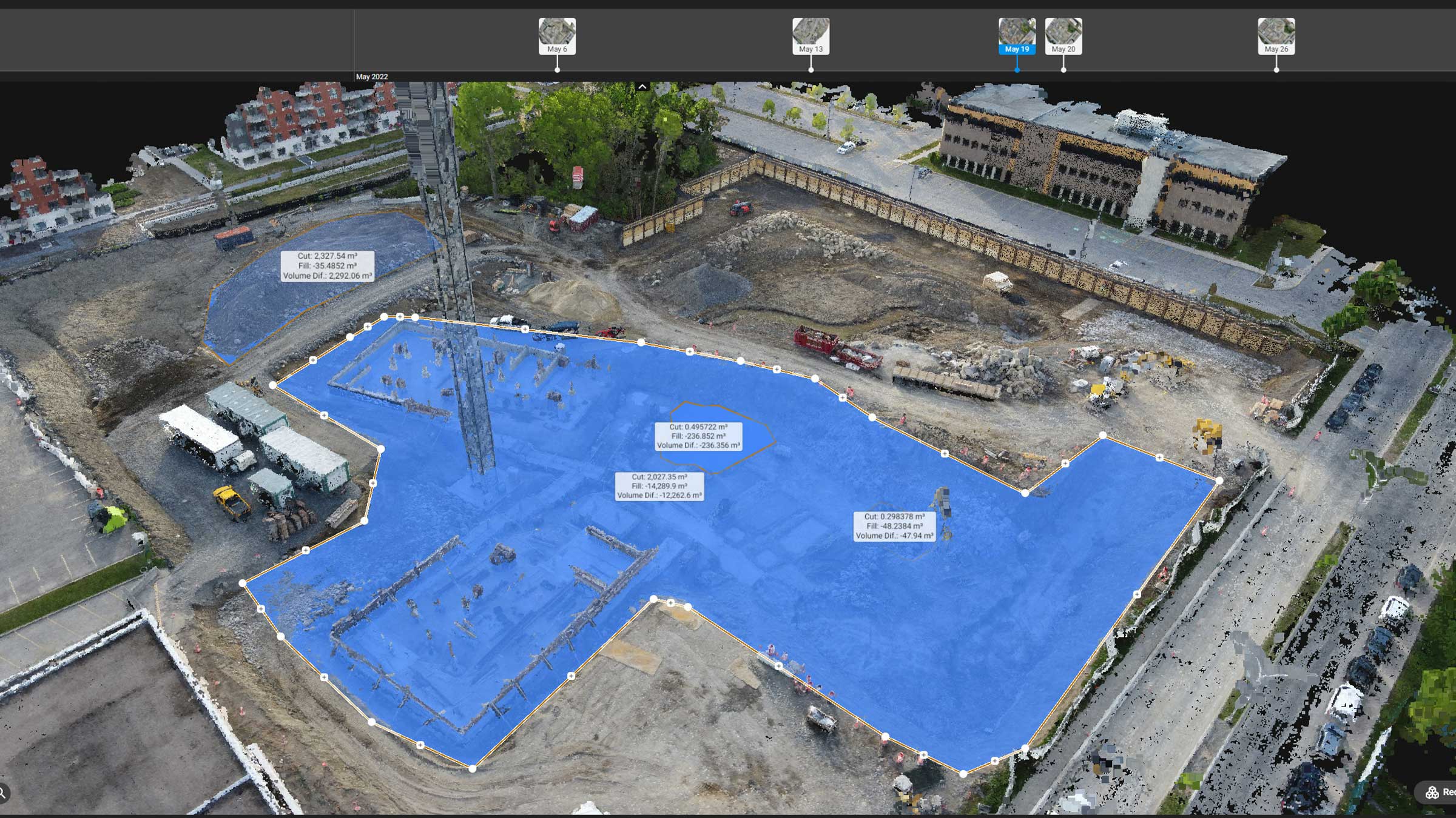
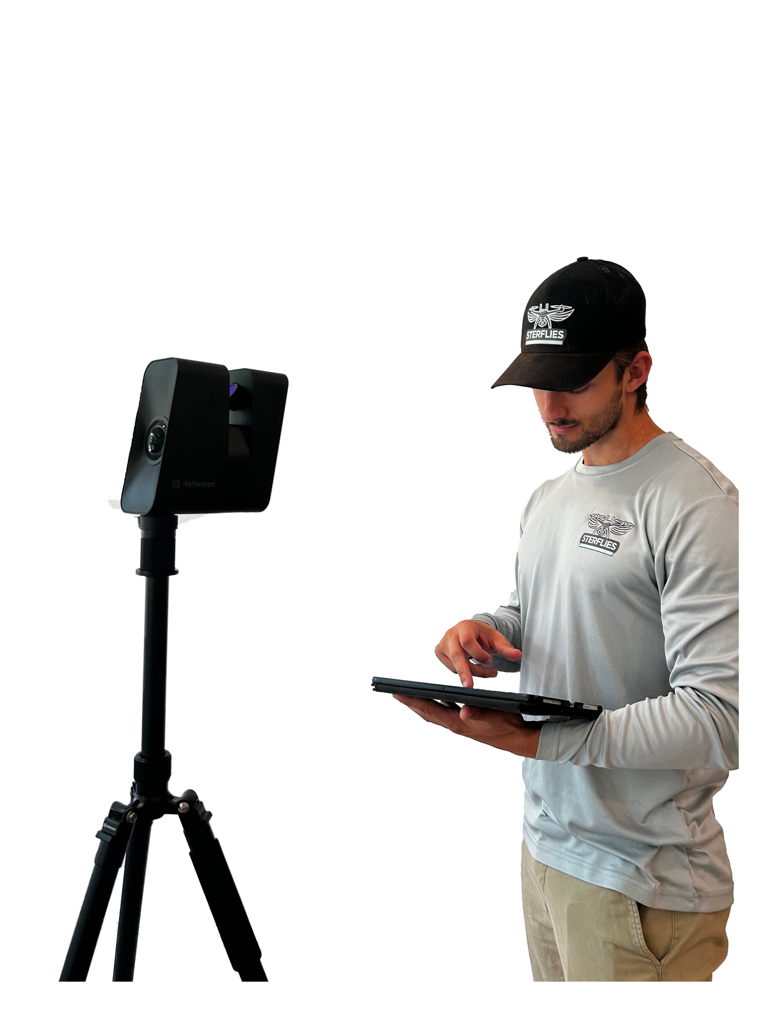
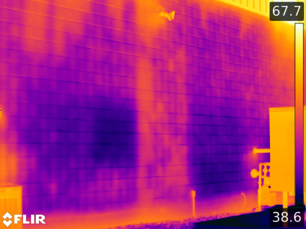
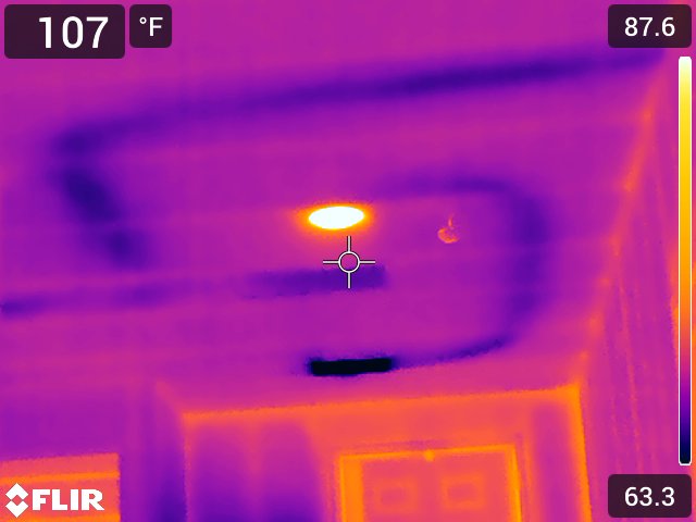
The biggest shift is that reality capture moves teams from describing to demonstrating. Orthomosaics provide scaled overhead context. Point clouds provide measurable geometry. Three dimensional mesh models allow experts to evaluate surfaces and structures from multiple perspectives. Immersive interior capture provides a navigable record that remote stakeholders can explore without travel. Radiometric thermal data preserves temperature information that can support later analysis when questions arise about failure timing or hidden conditions.
In practice, this can reduce interpretive conflict. When parties disagree about distance, slope, line of sight, clearance, or relative location, the conversation can shift away from memory and toward measurable reference. That shift changes the tone of mediation, the precision of expert opinions, and the confidence of decision makers evaluating exposure.
The market is expanding because the value is measurable
This shift is not happening in a vacuum. Commercial drone services have grown rapidly as industries push toward faster, safer, and more repeatable inspection and documentation workflows. Grand View Research estimates the global commercial drone market was about 30.02 billion dollars in 2024 and projects continued growth through 2030, driven by expanding enterprise adoption across inspection and documentation use cases. That growth matters in legal disputes because it reflects mainstream adoption, which increases comfort among insurers, consultants, and experts who will later be asked to defend methodology.
Reality capture expansion is not only about drones. The 3D scanning ecosystem continues to grow as well, including terrestrial scanning, mobile scanning, and hybrid workflows. MarketsandMarkets projects the 3D scanners market to grow from about 1.1 billion dollars in 2023 to about 1.5 billion dollars by 2028. The more common these tools become across construction, insurance, and forensic engineering, the more likely they are to become expected in higher stakes disputes where the environment itself is central to the claim.
PwC has also highlighted the broader economic impact of drone powered business solutions, estimating a large total addressable market across multiple industries. While market estimates vary by methodology, the consistent theme is that drones and reality capture are increasingly treated as operational infrastructure rather than niche technology.
Thermal, interiors, and the advantage of layered evidence
Not every dispute needs every tool, but layered evidence can be strategic. Drone mapping can preserve exterior context, site access, and spatial relationships at scale. LiDAR can preserve measurable geometry when dimensional accuracy matters. Immersive interior models can preserve conditions that may be altered later, while allowing remote review by experts and counsel. Radiometric thermal capture can preserve temperature differentials that support later analysis when the conversation turns to hidden performance issues, timing, or whether conditions were present during a specific window.
This is also where professionalism shows. Capturing data is not the same as producing evidence. Evidence needs traceability. It needs time stamps, location context, and clear documentation of how the dataset was created. The goal is not to impress with visuals. The goal is to reduce ambiguity and strengthen defensibility.
Why this impacts outcomes
Disputes are often won or lost in the space between uncertainty and clarity. When a site is preserved as a measurable, navigable record, the range of plausible disagreement narrows. That can influence how experts frame opinions, how counsel evaluates exposure, and how quickly parties move toward resolution.
The future of site based disputes will not rely solely on recollection and static imagery. Increasingly, it will rely on persistent digital reality. The legal value is straightforward. When the environment is central to the claim, preserving that environment with defensible methodology becomes a strategic asset, not a nice to have.
References
- Grand View Research. Commercial Drone Market (global market size and growth). https://www.grandviewresearch.com/industry-analysis/global-commercial-drones-market
- MarketsandMarkets. 3D Scanners Market (market size and growth). https://www.marketsandmarkets.com/Market-Reports/3d-scanner-market-119952472.html
- PwC. Clarity from above, PwC global report on the commercial applications of drone technology (PDF). https://www.pwc.pl/pl/pdf/clarity-from-above-pwc.pdf
- Tsanakas, J. A., Ha, L., and Buerhop, C. (2016). Faults and infrared thermographic diagnosis in operating c-Si photovoltaic modules: A review of research and future challenges. Renewable and Sustainable Energy Reviews. https://www.sciencedirect.com/science/article/pii/S1364032116301629 (supporting background on thermography as measurement and interpretation in operating systems)
- Google Scholar search: drones photogrammetry LiDAR legal disputes evidence. https://scholar.google.com/scholar?q=drone+photogrammetry+LiDAR+legal+dispute+evidence
Need defensible digital site evidence for a dispute
SterFlies supports attorneys, consultants, and stakeholders with drone mapping, LiDAR scanning, immersive capture, and thermal datasets built for clarity, repeatability, and defensibility. When the site is central to the claim, the documentation should be measurable.